IMAGES TAKEN NEAR TO
Cotswold Avenue, IPSWICH, IP1 4LL
Introduction
This page details the photographs taken nearby to Cotswold Avenue, IP1 4LL by members of the Geograph project.
The Geograph project started in 2005 with the aim of publishing, organising and preserving representative images for every square kilometre of Great Britain, Ireland and the Isle of Man.

There are currently over 7.5m images from over14,400 individuals and you can help contribute to the project by visiting https://www.geograph.org.uk
Image Map
Images are licensed for reuse under creativecommons.org/licenses/by-sa/2.0
Notes
- Clicking on the map will re-center to the selected point.
- The higher the marker number, the further away the image location is from the centre of the postcode.
Image Listing (36 Images Found)
Images are licensed for reuse under creativecommons.org/licenses/by-sa/2.0
Image
Details
Distance
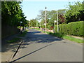
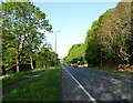
2
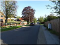
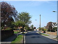
Cotswold Avenue
Looking at old maps, the road was constructed in the 1930s, but these houses may be post-war
Image: © Keith Edkins
Taken: 7 Aug 2018
0.06 miles
4
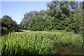
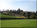
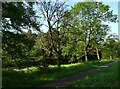
The Dales, Ipswich
The Dales is a 14-acre area of open space in the heart of the town that was formerly used for sand and clay excavations for local clay brickworks which closed in 1959. Evidence of the digging operation can still be seen.
Image: © Bob Jones
Taken: 28 Jun 2006
0.12 miles
8
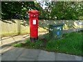
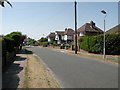
George V postbox on Dale Hall Lane
Postbox No. IP1 1303.
Image: © JThomas
Taken: 16 May 2023
0.14 miles