IMAGES TAKEN NEAR TO
Debenham Road, STOWMARKET, IP14 6BX
Introduction
This page details the photographs taken nearby to Debenham Road, IP14 6BX by members of the Geograph project.
The Geograph project started in 2005 with the aim of publishing, organising and preserving representative images for every square kilometre of Great Britain, Ireland and the Isle of Man.

There are currently over 7.5m images from over14,400 individuals and you can help contribute to the project by visiting https://www.geograph.org.uk
Image Map
Images are licensed for reuse under creativecommons.org/licenses/by-sa/2.0
Notes
- Clicking on the map will re-center to the selected point.
- The higher the marker number, the further away the image location is from the centre of the postcode.
Image Listing (7 Images Found)
Images are licensed for reuse under creativecommons.org/licenses/by-sa/2.0
Image
Details
Distance
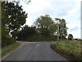
1
Entrance to Topcroft Equestrian Centre
Off Debenham Road
http://www.topthorn.co.uk/
Image: © Geographer
Taken: 17 Oct 2014
0.16 miles
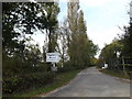
2
Debenham Road at Topthorn Equestrian Centre
Image: © Geographer
Taken: 17 Oct 2014
0.16 miles
3
Topthorn Equestrian Centre sign
Off Debenham Road
http://www.topthorn.co.uk/
Image: © Geographer
Taken: 17 Oct 2014
0.16 miles
4
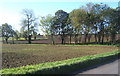
Fields and trees near Brook Farm
The trees run alongside the course of the stream marked on the map.
Image: © Andrew Hill
Taken: 17 Oct 2007
0.18 miles
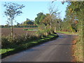
5
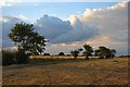
Farmland at Mickfield
The evening light casts long shadows across the fields, near Mickfield.
Image: © Bob Jones
Taken: 20 Jul 2007
0.18 miles
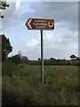
6
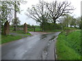
Road And Footpath Signs
Country road and footpath signs near to Mickfield, Suffolk.
Image: © Keith Evans
Taken: 6 May 2012
0.23 miles