IMAGES TAKEN NEAR TO
Debenham Road, STOWMARKET, IP14 5LQ
Introduction
This page details the photographs taken nearby to Debenham Road, IP14 5LQ by members of the Geograph project.
The Geograph project started in 2005 with the aim of publishing, organising and preserving representative images for every square kilometre of Great Britain, Ireland and the Isle of Man.

There are currently over 7.5m images from over14,400 individuals and you can help contribute to the project by visiting https://www.geograph.org.uk
Image Map
Images are licensed for reuse under creativecommons.org/licenses/by-sa/2.0
Notes
- Clicking on the map will re-center to the selected point.
- The higher the marker number, the further away the image location is from the centre of the postcode.
Image Listing (72 Images Found)
Images are licensed for reuse under creativecommons.org/licenses/by-sa/2.0
Image
Details
Distance
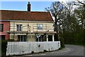
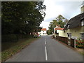
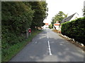
2
Mickfield: Houses at the crossroads
Image: © Michael Garlick
Taken: 30 Apr 2021
0.01 miles
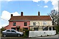
3
Wetheringsett Road, Mickfield
At the junction with Debenham & Mickfield Road
Image: © Geographer
Taken: 17 Oct 2014
0.01 miles
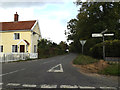
4
Debenham Road, Mickfield
Looking towards the junction with the A140 Norwich Road at the junction with Mickfield & Wetheringsett Roads
Road No.C483
Image: © Geographer
Taken: 17 Oct 2014
0.02 miles
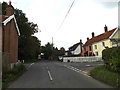
5
Mickfield Road, Mickfield
Looking towards Debenham Road
Road No.C484
Image: © Geographer
Taken: 17 Oct 2014
0.02 miles
6
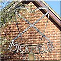
Mickfield village sign (detail)
The village sign is located by the Old Forge, not far from the crossroads. It shows two scythes, reminiscent of the farming community, affixed to a saltire, for the church of St Andrew which create a shield-like image above the nameplate. There are two small fritillary flowers hanging their heads below the name, symbolic of those which grow in abundance on Fritillary Meadow.
Image: © Adrian S Pye
Taken: 12 Dec 2020
0.02 miles
7
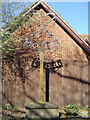
Mickfield village sign
The village sign is located by the Old Forge, not far from the crossroads. It shows two crossed scythes, reminiscent of the farming community, affixed to a saltire, for the church of St Andrew which create a shield-like image above the nameplate. There are two small fritillary flowers hanging their heads below the name, symbolic of those which grow in abundance on Fritillary Meadow.
Image: © Adrian S Pye
Taken: 12 Mar 2007
0.02 miles
8
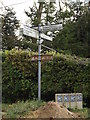
Roadsign on Debenham Road
At the junction with Mickfield & Wetheringsett Roads
Road No.C483
Image: © Geographer
Taken: 17 Oct 2014
0.02 miles
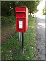
9
Mickfield Road & Upper Town Postbox
Postbox No.IP14 8092
Image: © Geographer
Taken: 12 Sep 2015
0.04 miles
10
Upper Town Postbox
On Mickfield Road
Postbox No.IP14 8092
Image: © Geographer
Taken: 12 Sep 2015
0.04 miles