
IMAGES TAKEN NEAR TO
School Lane, STOWMARKET, IP14 5EL
Introduction
This page details the photographs taken nearby to School Lane, IP14 5EL by members of the Geograph project.
The Geograph project started in 2005 with the aim of publishing, organising and preserving representative images for every square kilometre of Great Britain, Ireland and the Isle of Man.

There are currently over 7.5m images from over14,400 individuals and you can help contribute to the project by visiting https://www.geograph.org.uk
Image Map
Images are licensed for reuse under creativecommons.org/licenses/by-sa/2.0
Notes
- Clicking on the map will re-center to the selected point.
- The higher the marker number, the further away the image location is from the centre of the postcode.
Image Listing (47 Images Found)
Images are licensed for reuse under creativecommons.org/licenses/by-sa/2.0
Image
Details
Distance
1
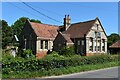
The Old School House, Forward Green, Earl Stonham
The school was built in 1870 on land at the southern end of Forrolde (now Forward) Green. It is now a private house.
Image: © Simon Mortimer
Taken: 16 Jul 2021
0.05 miles
2
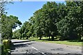
Trees on Forward Green
Forward Green is one of several satellite settlements in the parish of Earl Stonham. The trees here line the green alongside the A1120.
Image: © Simon Mortimer
Taken: 16 Jul 2021
0.06 miles
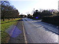
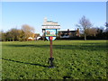
5
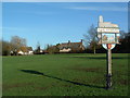
Village Green Earl Stonham
Village green and sign Earl Stonham Suffolk. For detail of sign see http://www.geograph.org.uk/photo/311632 and http://www.geograph.org.uk/photo/311761
Image: © Keith Evans
Taken: 14 Jan 2007
0.09 miles
6
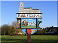
Earl Stonham Village Sign
Off the A1120
(Close up)
Image: © Geographer
Taken: 19 Dec 2008
0.10 miles
7
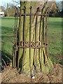
It's Getting Tight
Metal railing around tree on the village green getting a bit small now Earl Stonham Suffolk.
Image: © Keith Evans
Taken: 14 Jan 2007
0.10 miles
9

Earl Stonham village sign
The sign is surmounted by the church of St Mary and below is a depiction of a Roman chariot flanked by a blacksmith on the left and a plough-boy on the right. Below the sign in the spandrels is a woman drawing water from the village pump and what appears to be a wickerwork basket. A shield on the post reads ER 11 - 1977, which I presume is meant to be ER II.
There is no guidance on the parish website except about the Romans who had a way-station here. https://www.geograph.org.uk/photo/4291932
Image: © Adrian S Pye
Taken: 23 May 2007
0.10 miles
10
Earl Stonham village sign
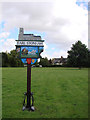
The sign is surmounted by the church of St Mary and below is a depiction of a Roman chariot flanked by a blacksmith on the left and a plough-boy on the right. Below the sign in the spandrels is a woman drawing water from the village pump and what appears to be a wickerwork basket. A shield on the post reads ER 11 - 1977, which I presume is meant to be ER II.
There is no guidance on the parish website except about the Romans who had a way-station here.
Image: © Adrian S Pye
Taken: 23 May 2007
0.10 miles