
IMAGES TAKEN NEAR TO
Cardinalls Road, STOWMARKET, IP14 5AA
Introduction
This page details the photographs taken nearby to Cardinalls Road, IP14 5AA by members of the Geograph project.
The Geograph project started in 2005 with the aim of publishing, organising and preserving representative images for every square kilometre of Great Britain, Ireland and the Isle of Man.

There are currently over 7.5m images from over14,400 individuals and you can help contribute to the project by visiting https://www.geograph.org.uk
Image Map
Images are licensed for reuse under creativecommons.org/licenses/by-sa/2.0
Notes
- Clicking on the map will re-center to the selected point.
- The higher the marker number, the further away the image location is from the centre of the postcode.
Image Listing (69 Images Found)
Images are licensed for reuse under creativecommons.org/licenses/by-sa/2.0
Image
Details
Distance
1
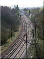
Western rail approach to Stowmarket
Two level crossings are visible - the first is in a minor residential street, the second (with car crossing it) is beside the station. The signal box and the station platform are visible behind the car.
Image: © John Goldsmith
Taken: 26 Mar 2009
0.06 miles
2
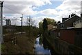
Stowmarket: River Gipping between Regent Street and the railway
At the extreme top left, a security camera watches over the Crown Street level crossing.
Image: © Christopher Hilton
Taken: 25 Mar 2019
0.07 miles
3
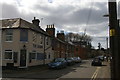
Crown Street, Stowmarket
On the left, the Crown pub from which the street presumably gets its name.
Image: © Christopher Hilton
Taken: 25 Mar 2019
0.07 miles
4
Stowmarket: Jehovah's Witnesses' Kingdom Hall
Image: © Christopher Hilton
Taken: 25 Mar 2019
0.08 miles
5
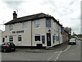
'The Crown' public house, Stowmarket
On the corner of Regent Street and Crown Street; how very appropriate.
http://www.geograph.org.uk/photo/5361626
Image: © Adrian S Pye
Taken: 23 Apr 2017
0.08 miles
6
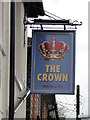
The hanging sign of 'The Crown' public house
http://www.geograph.org.uk/photo/5361622
Image: © Adrian S Pye
Taken: 23 Apr 2017
0.08 miles
9
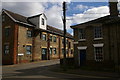
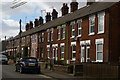
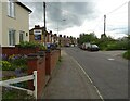
Former mill building, Bond Street, Stowmarket
On the right is the end of Regent Terrace, as the carved sign announces. The sign can be seen close-up at Image
A similar carved sign on the mill announces its name and date of construction: Image
Image: © Christopher Hilton
Taken: 25 Mar 2019
0.10 miles
10
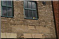
Name stone on former Albert Mill, Bond Street, Stowmarket
Albert Mill is now converted to housing. The mill itself can be seen at Image
Image: © Christopher Hilton
Taken: 25 Mar 2019
0.10 miles