IMAGES TAKEN NEAR TO
Walsham Road, STOWMARKET, IP14 4JQ
Introduction
This page details the photographs taken nearby to Walsham Road, IP14 4JQ by members of the Geograph project.
The Geograph project started in 2005 with the aim of publishing, organising and preserving representative images for every square kilometre of Great Britain, Ireland and the Isle of Man.

There are currently over 7.5m images from over14,400 individuals and you can help contribute to the project by visiting https://www.geograph.org.uk
Image Map
Images are licensed for reuse under creativecommons.org/licenses/by-sa/2.0
Notes
- Clicking on the map will re-center to the selected point.
- The higher the marker number, the further away the image location is from the centre of the postcode.
Image Listing (6 Images Found)
Images are licensed for reuse under creativecommons.org/licenses/by-sa/2.0
Image
Details
Distance
2
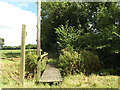
Footpath to Back Street
Off the B1113 Walsham Road
Image: © Geographer
Taken: 29 Aug 2016
0.10 miles
3
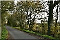
Rookery Farm
The B1113 looking north west with Rookery Farm near to Finningham, Suffolk.
Image: © Keith Evans
Taken: 9 Nov 2008
0.12 miles
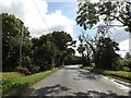
4
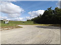
Entrance to Rob Hall Farm
Off the B1113 Walsham Road
Image: © Geographer
Taken: 29 Aug 2016
0.22 miles
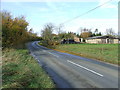
5
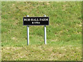
Rob Hall Farm sign
At the entrance to Rob Hall Farm off the B1113 Walsham Road
Image: © Geographer
Taken: 29 Aug 2016
0.22 miles