IMAGES TAKEN NEAR TO
Cranesbill Way, STOWMARKET, IP14 4FB
Introduction
This page details the photographs taken nearby to Cranesbill Way, IP14 4FB by members of the Geograph project.
The Geograph project started in 2005 with the aim of publishing, organising and preserving representative images for every square kilometre of Great Britain, Ireland and the Isle of Man.

There are currently over 7.5m images from over14,400 individuals and you can help contribute to the project by visiting https://www.geograph.org.uk
Image Map
Images are licensed for reuse under creativecommons.org/licenses/by-sa/2.0
Notes
- Clicking on the map will re-center to the selected point.
- The higher the marker number, the further away the image location is from the centre of the postcode.
Image Listing (33 Images Found)
Images are licensed for reuse under creativecommons.org/licenses/by-sa/2.0
Image
Details
Distance
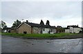
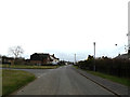
1
Gipping Road, Stowupland
At the junction with Columbyne Close
Image: © Geographer
Taken: 26 Mar 2016
0.06 miles
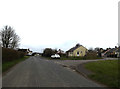
2
Columbyne Close, Stowupland
At the junction with Gipping Road
Image: © Geographer
Taken: 26 Mar 2016
0.07 miles
3
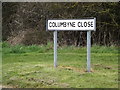
Columbyne Close sign
On Columbyne Close at the junction with Gipping Road
Image: © Geographer
Taken: 26 Mar 2016
0.07 miles
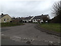
4
Gipping Road, Stowupland
At the junction with Trinity Walk
Image: © Geographer
Taken: 26 Mar 2016
0.08 miles
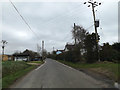
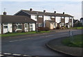
6
Entering Stowupland
Looking along Columbyne Close.
Image: © Andrew Hill
Taken: 14 Nov 2008
0.09 miles
7
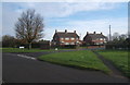
Gipping Road at the turn for Trinity Walk
Houses in Stowupland village.
Image: © Andrew Hill
Taken: 14 Nov 2008
0.09 miles
8
Reeds Way, Stowupland
Leading to quite a lot of recent housing development.
Image: © Andrew Hill
Taken: 14 Nov 2008
0.14 miles
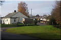
9
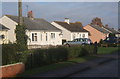
Bungalows on Thorney Green Road
In the Suffolk village of Stowupland.
Image: © Andrew Hill
Taken: 14 Nov 2008
0.14 miles