IMAGES TAKEN NEAR TO
Faiers Close, IP14 3SH
Introduction
This page details the photographs taken nearby to Faiers Close, IP14 3SH by members of the Geograph project.
The Geograph project started in 2005 with the aim of publishing, organising and preserving representative images for every square kilometre of Great Britain, Ireland and the Isle of Man.

There are currently over 7.5m images from over14,400 individuals and you can help contribute to the project by visiting https://www.geograph.org.uk
Image Map
Images are licensed for reuse under creativecommons.org/licenses/by-sa/2.0
Notes
- Clicking on the map will re-center to the selected point.
- The higher the marker number, the further away the image location is from the centre of the postcode.
Image Listing (42 Images Found)
Images are licensed for reuse under creativecommons.org/licenses/by-sa/2.0
Image
Details
Distance
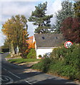
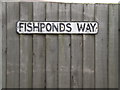
1
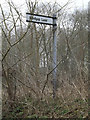
Roadsign on Fishponds Way
At the junction with Windgap Lane
Image: © Geographer
Taken: 3 Apr 2015
0.10 miles
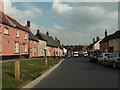
2
Fishponds Way, Haughley
At the junction with Windgap Lane
Image: © Geographer
Taken: 3 Apr 2015
0.10 miles
3
Windgap Lane, Haughley
At the junction with Fishponds Way
Image: © Geographer
Taken: 3 Apr 2015
0.10 miles
4
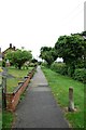
Pathway alongside Fishponds Way
Running south from St Mary's Avenue
Image: © John Myers
Taken: 28 May 2014
0.10 miles
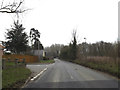
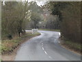
5
Entering Haughley from the south
The lane to Haughley used to approach from a difficult junction on the notorious "Haughley bends" on the A14 which have recently been by-passed to the southwest.
Image: © Andrew Hill
Taken: 16 Oct 2008
0.11 miles
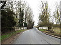
6
Entering Haughley on Fishponds Way
(Close up)
Image: © Geographer
Taken: 3 Apr 2015
0.19 miles
9
Fishponds Way sign
On Fishponds Way at the junction with Station Road & Old Street
Image: © Geographer
Taken: 3 Apr 2015
0.20 miles
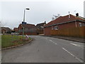
10
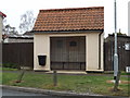
Bus Shelter on Station Road
At the junction with Old Street
Image: © Geographer
Taken: 3 Apr 2015
0.20 miles