IMAGES TAKEN NEAR TO
Upper Town, STOWMARKET, IP14 3NE
Introduction
This page details the photographs taken nearby to Upper Town, IP14 3NE by members of the Geograph project.
The Geograph project started in 2005 with the aim of publishing, organising and preserving representative images for every square kilometre of Great Britain, Ireland and the Isle of Man.

There are currently over 7.5m images from over14,400 individuals and you can help contribute to the project by visiting https://www.geograph.org.uk
Image Map
Images are licensed for reuse under creativecommons.org/licenses/by-sa/2.0
Notes
- Clicking on the map will re-center to the selected point.
- The higher the marker number, the further away the image location is from the centre of the postcode.
Image Listing (10 Images Found)
Images are licensed for reuse under creativecommons.org/licenses/by-sa/2.0
Image
Details
Distance
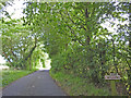
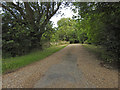
2
Lane near Fox Farm
Seen in late afternoon spring sunshine.
Image: © Andrew Hill
Taken: 22 Apr 2009
0.06 miles
3
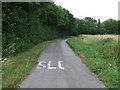
Half A Word
The word slow partly obliterated after road repair looking towards Willow Wood near to Wetherden, Suffolk
Image: © Keith Evans
Taken: 8 Jul 2009
0.11 miles
4
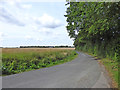
Minor road taking a sharp turn to the left
Image: © Adrian S Pye
Taken: 21 Jul 2019
0.11 miles
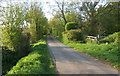
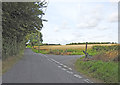
6
Lane towards Willow Wood
The lane changes direction sharply twice as it connects lanes heading north from Elmswell and Wetherden.
Image: © Andrew Hill
Taken: 22 Apr 2009
0.13 miles
7
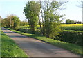
Lane towards Wetherden
Box Tree Farm is at the right of the picture.
Image: © Andrew Hill
Taken: 22 Apr 2009
0.19 miles
8
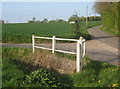
Lane junction
Between Wetherden and Wetherden Upper Town.
Image: © Andrew Hill
Taken: 22 Apr 2009
0.22 miles
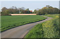
9
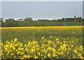
Yellow spring fields
A crop of oil-seed rape comes into bloom in this view towards Sulyards farm and Chestnut Farm, Wetherden Upper Town.
Image: © Andrew Hill
Taken: 22 Apr 2009
0.22 miles
10
Destroyed roadsign at Wetherden Road junction
Image: © Adrian S Pye
Taken: 21 Jul 2019
0.24 miles