IMAGES TAKEN NEAR TO
Buxhall, STOWMARKET, IP14 3DH
Introduction
This page details the photographs taken nearby to IP14 3DH by members of the Geograph project.
The Geograph project started in 2005 with the aim of publishing, organising and preserving representative images for every square kilometre of Great Britain, Ireland and the Isle of Man.

There are currently over 7.5m images from over14,400 individuals and you can help contribute to the project by visiting https://www.geograph.org.uk
Image Map
Images are licensed for reuse under creativecommons.org/licenses/by-sa/2.0
Notes
- Clicking on the map will re-center to the selected point.
- The higher the marker number, the further away the image location is from the centre of the postcode.
Image Listing (8 Images Found)
Images are licensed for reuse under creativecommons.org/licenses/by-sa/2.0
Image
Details
Distance
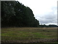
1
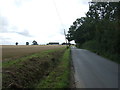
Heading south west near Purplehill Farm
Towards Buxhall.
Image: © JThomas
Taken: 14 Sep 2015
0.11 miles
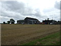
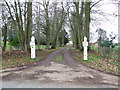
3
Brook Farm, Buxhall
Viewed from the footpath at Purple Hill.
Image: © Bob Jones
Taken: 25 Aug 2015
0.13 miles

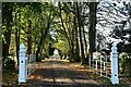
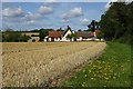
8
Entrance To Buxhall Vale
Gate post at the entrance to Buxhall Vale near to Buxhall, Suffolk.
Image: © Keith Evans
Taken: 30 Jan 2011
0.18 miles