IMAGES TAKEN NEAR TO
Bures Close, STOWMARKET, IP14 2PL

Introduction

This page details the photographs taken nearby to Bures Close, IP14 2PL by members of the Geograph project.

The Geograph project started in 2005 with the aim of publishing, organising and preserving representative images for every square kilometre of Great Britain, Ireland and the Isle of Man.

There are currently over 7.5m images from over14,400 individuals and you can help contribute to the project by visiting https://www.geograph.org.uk

Image Map


Images are licensed for reuse under creativecommons.org/licenses/by-sa/2.0
Notes
  • Clicking on the map will re-center to the selected point.
  • The higher the marker number, the further away the image location is from the centre of the postcode.

Image Listing (12 Images Found)

Images are licensed for reuse under creativecommons.org/licenses/by-sa/2.0
Image
Details
Distance
1
Old house at Stowmarket, Suffolk
This old timber-framed house stands on part of the original main road from Needham Market.
Image: © Robert Edwards Taken: 6 Sep 2006
0.03 miles
2
Houses near the Combs Ford roundabout
Looking across the end of Gipping Way to houses on Needham Road.
Image: © Andrew Hill Taken: 17 Feb 2010
0.06 miles
3
Roundabout on Gipping Way, Combs Ford
Image: © David Howard Taken: 27 Jul 2019
0.08 miles
4
Park area with flooding
Ducks enjoying a temporary pool in the park in the angle between Needham Road and Ipswich Road.
Image: © Andrew Hill Taken: 2 Mar 2010
0.17 miles
5
Old Milepost
Old milepost on what was the old A.45 near to Combs Ford, Suffolk. For close up view see http://www.geograph.org.uk/photo/1168599 for info on the post see http://milestones.megalithia.com/sites/missing.php?site_status=onmap&site_fb=1&site_ngr=TM058575&site_name=Stowmarket&site_surveyed=2002 do look at their home page.
Image: © Keith Evans Taken: 18 Feb 2009
0.19 miles
6
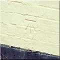
Cut Mark Stowmarket No 145 Lime Tree Place
Cut Mark Stowmarket No 145 Lime Tree Place SW face, S angle.
Image: © Cud05 Taken: 31 Mar 2018
0.21 miles
7
To Bury 15
Old milepost on what was the old A.45 near to Combs Ford, Suffolk. For overall view see http://www.geograph.org.uk/photo/1168605 For more info see http://milestones.megalithia.com/sites/missing.php?site_status=onmap&site_fb=1&site_ngr=TM058575&site_name=Stowmarket&site_surveyed=2002 do look at their home page.
Image: © Keith Evans Taken: 18 Feb 2009
0.22 miles
8
Cedars Hotel Combs
During the 19th Century this house was the family home of the Freeman family who planted the Cedar trees. On August 11th 1871 the roof was badly damaged by the explosion in Pentices Gun Cotton factory that was located to the north of the house.
Image: © Nick Balmer Taken: Unknown
0.22 miles
9
Bridge Widening
Stone tablet in bridge wall at Stowmarket, Suffolk see http://www.geograph.org.uk/photo/2252920 for overall view.
Image: © Keith Evans Taken: 30 Jan 2011
0.23 miles
10
River Gipping, Stowmarket
Part of a large industrial area on both sides of the river.
Image: © Andrew Hill Taken: 1 Apr 2010
0.23 miles