
IMAGES TAKEN NEAR TO
STOWMARKET, IP14 2AG
Introduction
This page details the photographs taken nearby to IP14 2AG by members of the Geograph project.
The Geograph project started in 2005 with the aim of publishing, organising and preserving representative images for every square kilometre of Great Britain, Ireland and the Isle of Man.

There are currently over 7.5m images from over14,400 individuals and you can help contribute to the project by visiting https://www.geograph.org.uk
Image Map
Images are licensed for reuse under creativecommons.org/licenses/by-sa/2.0
Notes
- Clicking on the map will re-center to the selected point.
- The higher the marker number, the further away the image location is from the centre of the postcode.
Image Listing (11 Images Found)
Images are licensed for reuse under creativecommons.org/licenses/by-sa/2.0
Image
Details
Distance
1
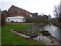
Muntons of Stowmarket
A factory complex by the River Gipping. Malt, malt extracts and malt flours are produced for the food and beverage industries around the world.
Image: © Andrew Hill
Taken: 1 Apr 2010
0.06 miles
2
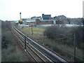
Works And Railway
Marked on the O.S. maps as Wks. Looking east along the railway line towards Ipswich. The complex on the right seems to belong to Muntons plc malt products - see their web site http://www.muntons.com/
Image: © Keith Evans
Taken: 15 Mar 2007
0.07 miles
3
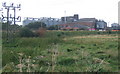
Muntons factory complex, Stowmarket
Seen from the Gipping Valley River Path. The railway is on an embankment in front of the factory, which produces 80,000 tonnes of malt per annum and 40,000 tonnes of malted ingredients per annum.
Image: © Andrew Hill
Taken: 6 Oct 2008
0.15 miles
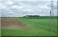
5
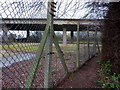
Gipping footpath and the elevated A1120
The footpath cannot be pictured without the ever present high wire fence forming the boundary for the large industrial sites nearby.
Image: © Andrew Hill
Taken: 1 Apr 2010
0.22 miles
6
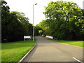
Access road, Muntons maltings
See http://www.muntons.com/
Image: © Chris Holifield
Taken: 21 Jun 2011
0.22 miles
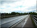
8
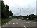
A1120 at Stowmarket
Approaching the junction with the B1113 & A1308 Needham Roads
Image: © Geographer
Taken: 14 Jun 2014
0.23 miles
9
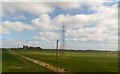
View uphill towards Clamp Farm, from the railway
Image: © Christopher Hilton
Taken: 25 Mar 2019
0.24 miles
10
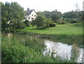
Riverside property
Travellers on the B1113 are not aware that the river is so close by.
Image: © Andrew Hill
Taken: 6 Oct 2008
0.25 miles