
IMAGES TAKEN NEAR TO
Tavern Court, STOWMARKET, IP14 1PL
Introduction
This page details the photographs taken nearby to Tavern Court, IP14 1PL by members of the Geograph project.
The Geograph project started in 2005 with the aim of publishing, organising and preserving representative images for every square kilometre of Great Britain, Ireland and the Isle of Man.

There are currently over 7.5m images from over14,400 individuals and you can help contribute to the project by visiting https://www.geograph.org.uk
Image Map
Images are licensed for reuse under creativecommons.org/licenses/by-sa/2.0
Notes
- Clicking on the map will re-center to the selected point.
- The higher the marker number, the further away the image location is from the centre of the postcode.
Image Listing (348 Images Found)
Images are licensed for reuse under creativecommons.org/licenses/by-sa/2.0
Image
Details
Distance
1

Stowmarket, Wilkes Way: Half price stall
Image: © Michael Garlick
Taken: 11 Mar 2023
0.02 miles
2
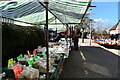
Stowmarket, Wilkes Way: Bird food and other requisites from a stall
Image: © Michael Garlick
Taken: 11 Mar 2023
0.03 miles
5
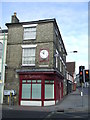
Shop At Road Junction
Shop at road junction Stowmarket, Suffolk note the old enamelled sign for the station see http://www.geograph.org.uk/photo/2253191 for close up view.
Image: © Keith Evans
Taken: 30 Jan 2011
0.03 miles
6
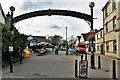
Stowmarket: The Meadow Shopping Centre
Image: © Michael Garlick
Taken: 11 Mar 2023
0.03 miles
7

Stowmarket, Wilkes Way: Haberdashery stall
Image: © Michael Garlick
Taken: 11 Mar 2023
0.03 miles
8
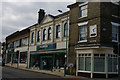
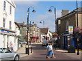
Corner of Tavern Street, Stowmarket
Note, on the extreme right, the 1950s British Railways sign pointing to the station: the dark blue colour was used at this time by the Eastern Region and nodded to the livery of the Great Eastern Railway, its predecessor. The "totem" logo used here is characteristic of the 1950s: it was designed by A.J. White shortly after the 1948 nationalisation of the railways, building on the London Underground bar-and-circle logo, and ceased to be used after the brand refresh of the early 1960s.
The sign can be seen in more detail at Image and Image
Image: © Christopher Hilton
Taken: 18 Aug 2018
0.04 miles
9
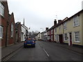
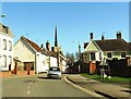
B1115 Finborough Road, Stowmarket
Approaching the junction with Market Place & Bury Street
Image: © Geographer
Taken: 3 Apr 2015
0.04 miles
10
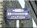
Old Enamelled Sign
Old enamelled British Railways sign directing the direction to the station, Stowmarket, Suffolk; for overall location view see http://www.geograph.org.uk/photo/2253190
Image: © Keith Evans
Taken: 30 Jan 2011
0.04 miles