IMAGES TAKEN NEAR TO
Gipping Way, IP14 1GJ

Introduction

This page details the photographs taken nearby to Gipping Way, IP14 1GJ by members of the Geograph project.

The Geograph project started in 2005 with the aim of publishing, organising and preserving representative images for every square kilometre of Great Britain, Ireland and the Isle of Man.

There are currently over 7.5m images from over14,400 individuals and you can help contribute to the project by visiting https://www.geograph.org.uk

Image Map


Images are licensed for reuse under creativecommons.org/licenses/by-sa/2.0
Notes
  • Clicking on the map will re-center to the selected point.
  • The higher the marker number, the further away the image location is from the centre of the postcode.

Image Listing (366 Images Found)

Images are licensed for reuse under creativecommons.org/licenses/by-sa/2.0
  • ...
Image
Details
Distance
1
Stowmarket: almshouses along the churchyard
Image: © Christopher Hilton Taken: 25 Mar 2019
0.02 miles
2
A1308 Gipping Way, Stowmarket
At the junction with the B1115 Station Road East & B1115 Station Road West
Image: © Geographer Taken: 14 Jun 2014
0.02 miles
3
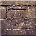
Cut Mark Stowmarket No 10 Station Road West
Cut Mark Stowmarket No 10 Station Road West NW face, N angle.
Image: © Cud05 Taken: 2 Nov 2017
0.02 miles
4
Stowmarket: almshouses along the churchyard
Image: © Christopher Hilton Taken: 18 Aug 2018
0.02 miles
5
Gipping Way sign
On the A1308 Gipping Way at the junction with the B1115 Station Road East & B1115 Station Road West
Image: © Geographer Taken: 14 Jun 2014
0.03 miles
6
Church Walk
A quiet backwater in the heart of the town, overlooking the churchyard.
Image: © Tim Marchant Taken: 21 Sep 2010
0.03 miles
7
Cottages by the churchyard
A springtime view of the row of houses at the east end of the churchyard.
Image: © Andrew Hill Taken: 10 Apr 2010
0.03 miles
8
Stowmarket: towards the parish church
The grand house on the left is Grade II* listed: "Early C18 timber-framed house, re-worked mid C18 with new brick additions and facade. Slate roof, plain tiled to rear. Facade of gault brick with red brick dressings. Three storeys in five bays". The raised and railed pavement opposite is The Karnser, which takes its name from “caunsey", an East Anglian dialect word for a causeway. The sun had yet to break through stubborn cloud on a June morning.
Image: © John Sutton Taken: 20 Jun 2018
0.03 miles
9
Gipping Way (A1308), Stowmarket
Image: © JThomas Taken: 9 May 2012
0.03 miles
10
Station Road West towards the junction
The junction is the busiest in Stowmarket. The churchyard hedge hides the traffic.
Image: © Andrew Hill Taken: 10 Apr 2010
0.04 miles
  • ...