1
Gipping Way sign
On the A1308 Gipping Way at the junction with the B1115 Station Road East & B1115 Station Road West
Image: © Geographer
Taken: 14 Jun 2014
0.02 miles
2
Station Road bridge over River Gipping, Stowmarket
Image: © Christopher Hilton
Taken: 25 Mar 2019
0.02 miles
3
A1308 Gipping Way, Stowmarket
At the junction with the B1115 Station Road East & B1115 Station Road West
Image: © Geographer
Taken: 14 Jun 2014
0.03 miles
4
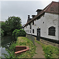
Stowmarket: The Maltings and the River Gipping
This Grade II listed malthouse was later used as a warehouse and more recently housed a restaurant.
Image: © John Sutton
Taken: 20 Jun 2018
0.03 miles
5
The Maltings and the River Gipping, Stowmarket
The Gipping was navigable from here down to Ipswich as the Ipswich & Stowmarket Navigation; it carried malt out to sea-going ships that carried from Ipswich to larger markets such as London.
Image: © Christopher Hilton
Taken: 25 Mar 2019
0.03 miles
6
River Gipping in Stowmarket
Looking towards the Station Road bridge, which is the end of the river path from Ipswich.
Image: © Andrew Hill
Taken: 1 Apr 2010
0.03 miles
7
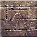
Cut Mark Stowmarket No 10 Station Road West
Cut Mark Stowmarket No 10 Station Road West NW face, N angle.
Image: © Cud05
Taken: 2 Nov 2017
0.04 miles
8
The River Gipping, Stowmarket
Looking north from the bridge on Station Road East.
Image: © JThomas
Taken: 17 Sep 2015
0.04 miles
9
The River Gipping
A tributary of the Orford.
Image: © Matthew Hatton
Taken: 30 Apr 2011
0.04 miles
10
Stowmarket: towards the parish church
The grand house on the left is Grade II* listed: "Early C18 timber-framed house, re-worked mid C18 with new brick additions and facade. Slate roof, plain tiled to rear. Facade of gault brick with red brick dressings. Three storeys in five bays". The raised and railed pavement opposite is The Karnser, which takes its name from “caunsey", an East Anglian dialect word for a causeway.
The sun had yet to break through stubborn cloud on a June morning.
Image: © John Sutton
Taken: 20 Jun 2018
0.04 miles


