IMAGES TAKEN NEAR TO
Lady Lane, IPSWICH, IP1 3EA

Introduction

This page details the photographs taken nearby to Lady Lane, IP1 3EA by members of the Geograph project.

The Geograph project started in 2005 with the aim of publishing, organising and preserving representative images for every square kilometre of Great Britain, Ireland and the Isle of Man.

There are currently over 7.5m images from over14,400 individuals and you can help contribute to the project by visiting https://www.geograph.org.uk

Image Map


Images are licensed for reuse under creativecommons.org/licenses/by-sa/2.0
Notes
  • Clicking on the map will re-center to the selected point.
  • The higher the marker number, the further away the image location is from the centre of the postcode.

Image Listing (359 Images Found)

Images are licensed for reuse under creativecommons.org/licenses/by-sa/2.0
  • ...
Image
Details
Distance
1
Lady Lane sign
See http://www.geograph.org.uk/photo/3970876 for the lane.
Image: © Hamish Griffin Taken: 21 Mar 2014
0.00 miles
2
Lady Lane, Ipswich
This doesn't appear on Google Maps, but does appear in my A-Z street atlas, If you put Lady Lane, Ipswich into Google Maps, it takes you onto Lady Lane, Hadleigh as Hadleigh's post town is Ipswich.
Image: © Hamish Griffin Taken: 21 Mar 2014
0.01 miles
3
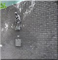
Virgin Mary Statue in Lady Lane, Ipswich
The statue and plaque below it is at the site of St Marys Chapel which was closed by order of Henry the VIII in 1588.
Image: © PAUL FARMER Taken: 22 May 2010
0.01 miles
4
Statue of Lady with a baby on Lady Lane
Maybe it has something to do with http://en.wikipedia.org/wiki/Our_Lady_of_Ipswich.
Image: © Hamish Griffin Taken: 21 Mar 2014
0.01 miles
5
Plaque below Lady statue
The plaque below http://www.geograph.org.uk/photo/3971007.
Image: © Hamish Griffin Taken: 21 Mar 2014
0.01 miles
6
The end of Westgate Street
Coming onto St. Matthew's Street/Crown Street. It is St. Matthew's Street left and Crown Street right but is the same road, the A1156.
Image: © Hamish Griffin Taken: 21 Mar 2014
0.01 miles
7
The back of a building on Lady Lane
Lady Lane is to the left.
Image: © Hamish Griffin Taken: 21 Mar 2014
0.01 miles
8
Industrial box on building
On http://www.geograph.org.uk/photo/3970990.
Image: © Hamish Griffin Taken: 21 Mar 2014
0.01 miles
9
Our Lady of Ipswich
The name of Lady Lane, an alley off Westgate, recalls that on this site stood the medieval shrine of Our Lady of Grace http://www.suffolkchurches.co.uk/ipsolg.htm. Among the Marian shrines in England, only that at Walsingham attracted more visitors. Along with many other such shrines, it was abolished in 1538 at the behest of Henry VIII, but it is believed that the oak statue was rescued by some sailors and after many wanderings found its way to the small port of Nettuno, near Anzio in Italy, where it is now venerated as La Madonna delle Grazie. This theory was corroborated in the 20th century when the Nettuno image, during restoration, was found to bear an inscription in Middle English. See http://www.nettunocitta.it/monumenti/madonna%20delle%20grazie/madonna%20delle%20grazie.htm (in Italian). This metal replica, based on the image at Nettuno, was made in 1990 by Robert Melamphy, who also carved a version in English oak which is now in Image which is the nearest parish church to the site of the original shrine.
Image: © Tiger Taken: 4 Aug 2012
0.02 miles
10
Westgate Street
Looking towards St Matthew's Street/Crown Street.
Image: © Hamish Griffin Taken: 5 Mar 2014
0.02 miles
  • ...