
IMAGES TAKEN NEAR TO
Easton Road, WOODBRIDGE, IP13 9LR
Introduction
This page details the photographs taken nearby to Easton Road, IP13 9LR by members of the Geograph project.
The Geograph project started in 2005 with the aim of publishing, organising and preserving representative images for every square kilometre of Great Britain, Ireland and the Isle of Man.

There are currently over 7.5m images from over14,400 individuals and you can help contribute to the project by visiting https://www.geograph.org.uk
Image Map
Images are licensed for reuse under creativecommons.org/licenses/by-sa/2.0
Notes
- Clicking on the map will re-center to the selected point.
- The higher the marker number, the further away the image location is from the centre of the postcode.
Image Listing (9 Images Found)
Images are licensed for reuse under creativecommons.org/licenses/by-sa/2.0
Image
Details
Distance
1
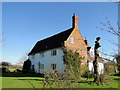
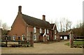
Woodlands, near Framlingham
An ancient house with 20th century extensions. Bricked-up windows in the gable end are the result of the Window Tax which was introduced in the late 17th century. Taken with the kind permission of the owner.
Image: © Adrian S Pye
Taken: 8 Feb 2011
0.02 miles
2

Kettleburgh: Pylon traversing a cereal crop
Image: © Michael Garlick
Taken: 8 May 2020
0.11 miles
3
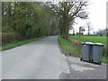
Bin Day
Wheelie bins out for collection near to Kettleburgh, Suffolk.
Image: © Keith Evans
Taken: 27 Mar 2014
0.12 miles
5
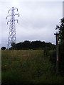
Footpath to the B1116 Woodbridge Road & Kettleburgh Road
Off Dark Lane
Image: © Geographer
Taken: 13 Jul 2010
0.12 miles
7
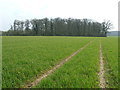
Rookery Wood
Rookery wood near to Kettleburgh, Suffolk.
Image: © Keith Evans
Taken: 27 Mar 2014
0.21 miles
8
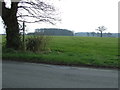
Footpath And Sign
Footpath across a field with Rookery Wood in the distance near to Kettleburgh, Suffolk.
Image: © Keith Evans
Taken: 27 Mar 2014
0.21 miles
9
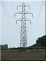
Pylons
Pylons across Suffolk looking southeast near to Framlingham, Suffolk.
Image: © Keith Evans
Taken: 30 Sep 2007
0.23 miles