1
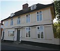
Ancient House, Albert Place, Framlingham
Ancient House dates from the late C17.
Image: © David Kemp
Taken: 10 Sep 2015
0.04 miles
2
Albert Place (B1116)
Image: © JThomas
Taken: 14 May 2023
0.05 miles
3
The United Free Church, Framlingham
The building, formerly the Methodist Church, is located on Albert Place.
Image: © Andrew Hill
Taken: 2 Jan 2010
0.05 miles
4
The Ancient House, Framlingham
The Ancient House is timber frame house with pargetting and tall windows dating the building as middle to late 17th century.
Off the B1116 Albert Place at the junction with Riverside
http://www.framlingham.com/history_detail.php?ID=3
Image: © Geographer
Taken: 5 Feb 2016
0.05 miles
5
The Ancient House, Framlingham
The Ancient House is timber frame house with pargetting and tall windows dating the building as middle to late 17th century.
Off the B1116 Albert Place at the junction with Riverside
(Close up)
http://www.framlingham.com/history_detail.php?ID=3
Image: © Geographer
Taken: 5 Feb 2016
0.05 miles
6
Electricity Sub-Station on Brook Lane
Image: © Geographer
Taken: 20 Jun 2011
0.05 miles
7
White Horse Public House, Well Close Square, Framlingham
Off the B1116 College Road at the junction with the B1116 Station Road, Bridge Street & New Road
Image: © Geographer
Taken: 21 Aug 2015
0.05 miles
8
White Horse Public House sign
At Well Close Square off the B1116 College Road at the junction with the B1116 Station Road, Bridge Street & New Road
(Close up)
Image: © Geographer
Taken: 21 Aug 2015
0.05 miles
9
B1116 Station Road, Framlingham
Looking towards Parham at the junction with the B1119 Fore Street
Image: © Geographer
Taken: 18 Jan 2009
0.05 miles
10
United Free Church, Framlingham
At the junction of Riverside and the B1116 Albert Place
Image: © Geographer
Taken: 18 Jan 2009
0.05 miles


