IMAGES TAKEN NEAR TO
Fairfield Road, WOODBRIDGE, IP13 9DQ

Introduction

This page details the photographs taken nearby to Fairfield Road, IP13 9DQ by members of the Geograph project.

The Geograph project started in 2005 with the aim of publishing, organising and preserving representative images for every square kilometre of Great Britain, Ireland and the Isle of Man.

There are currently over 7.5m images from over14,400 individuals and you can help contribute to the project by visiting https://www.geograph.org.uk

Image Map


Images are licensed for reuse under creativecommons.org/licenses/by-sa/2.0
Notes
  • Clicking on the map will re-center to the selected point.
  • The higher the marker number, the further away the image location is from the centre of the postcode.

Image Listing (606 Images Found)

Images are licensed for reuse under creativecommons.org/licenses/by-sa/2.0
  • ...
Image
Details
Distance
1
Driving up the road - and the path
Tractor and plough travelling through Framlingham
Image: © Adrian S Pye Taken: 8 Feb 2011
0.02 miles
2
Over grown former entrance to Mills Grammar School
On Fairfield Road - the over grown gate, wall and railings that once formed the frontage of Mills Grammar School, Framlingham. The school was open from 1902 to 1979. Until 1974 it was a school just for girls, but boys were admitted for the last five years. The decrepit steps still lay behind the gate, but a modern development of bungalows has been built beyond them.
Image: © Claire Haystead Taken: 19 May 2007
0.02 miles
3
Framlingham
Looking down Market Hill. Framlingham is an ancient market town with a current population of about 2,700.
Image: © Stephen McKay Taken: 29 May 2006
0.04 miles
4
Framlingham
Showing the town sign on Market Hill outside the Co-op.
Image: © Stephen McKay Taken: 29 May 2006
0.04 miles
5
'The Crown Hotel'
This was originally a coaching inn, built in 1553. It stands at the heart of the town where Market Hill meets Church Street.
Image: © Robert Edwards Taken: 5 Feb 2007
0.04 miles
6
Framlingham
Market Hill, leading towards the castle.
Image: © Elliott Simpson Taken: 15 Aug 2005
0.04 miles
7
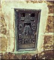
Flush Bracket OSBM S9643 Congregational Church Framlingham
Flush Bracket OSBM S9643 Congregational Church Framlingham SE angle, N side of street.
Image: © Cud05 Taken: 10 Mar 2016
0.05 miles
8
B1119 Fore Street, Framlingham
Looking towards Fairfield Road
Image: © Geographer Taken: 7 Nov 2008
0.05 miles
9
Public toilets
Public toilets Framlingham Suffolk.
Image: © Keith Evans Taken: 27 Aug 2008
0.05 miles
10
Carley's Yard, Framlington
A collection of antique shops.
Image: © Bikeboy Taken: 26 Aug 2014
0.05 miles
  • ...