IMAGES TAKEN NEAR TO
Badingham, WOODBRIDGE, IP13 8JL
Introduction
This page details the photographs taken nearby to IP13 8JL by members of the Geograph project.
The Geograph project started in 2005 with the aim of publishing, organising and preserving representative images for every square kilometre of Great Britain, Ireland and the Isle of Man.

There are currently over 7.5m images from over14,400 individuals and you can help contribute to the project by visiting https://www.geograph.org.uk
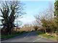
Image Map
Images are licensed for reuse under creativecommons.org/licenses/by-sa/2.0
Notes
- Clicking on the map will re-center to the selected point.
- The higher the marker number, the further away the image location is from the centre of the postcode.
Image Listing (33 Images Found)
Images are licensed for reuse under creativecommons.org/licenses/by-sa/2.0
Image
Details
Distance
1
Bend in the B1120 approaching Hill Farm
Image: © Christopher Hilton
Taken: 9 May 2021
0.06 miles
2
The B1120 looking towards the junction with the U2516
Image: © Geographer
Taken: 9 Sep 2006
0.06 miles
3
View across the Alde valley from the west
Image: © Christopher Hilton
Taken: 9 May 2021
0.09 miles
4
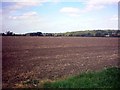
Fields next to the B1120 Framlingham Road
Dennington Wood is on the horizon
Image: © Geographer
Taken: 9 Sep 2006
0.09 miles
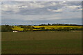
5
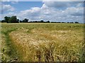
Barley field
Ripening barley in a field to the east of Dennington
Image: © Eileen Henderson
Taken: 20 Jun 2006
0.10 miles
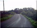
6
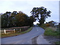
B1120 Badingham Road
Looking towards Badingham at the junction with the Low Road
Image: © Geographer
Taken: 31 Oct 2010
0.13 miles
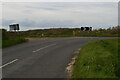
7
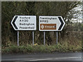
Roadsigns on the B1120
At the junction with the A1120 Dennington Road
Image: © Geographer
Taken: 5 Feb 2016
0.13 miles
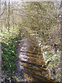
8
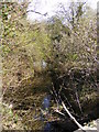
River Alde at Rook's Bridge
Off the A1120 Dennington Road
Image: © Geographer
Taken: 13 Apr 2010
0.14 miles
9
Road junction west of Badingham, Suffolk
Image: © nick macneill
Taken: 24 Mar 2012
0.15 miles
10
River Alde at Rook's Bridge
Off the A1120 Dennington Road
Image: © Geographer
Taken: 13 Apr 2010
0.15 miles