IMAGES TAKEN NEAR TO
Laxfield, WOODBRIDGE, IP13 8HW
Introduction
This page details the photographs taken nearby to IP13 8HW by members of the Geograph project.
The Geograph project started in 2005 with the aim of publishing, organising and preserving representative images for every square kilometre of Great Britain, Ireland and the Isle of Man.

There are currently over 7.5m images from over14,400 individuals and you can help contribute to the project by visiting https://www.geograph.org.uk
Image Map
Images are licensed for reuse under creativecommons.org/licenses/by-sa/2.0
Notes
- Clicking on the map will re-center to the selected point.
- The higher the marker number, the further away the image location is from the centre of the postcode.
Image Listing (23 Images Found)
Images are licensed for reuse under creativecommons.org/licenses/by-sa/2.0
Image
Details
Distance
1
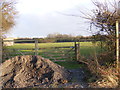
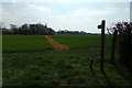
Footpath to Mill Road
Near Sunflower Farm
Image: © Geographer
Taken: 13 Jan 2012
0.17 miles
2
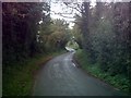
Low Street, Badingham
Near Sunflower Farm
Road No.C215
Image: © Geographer
Taken: 29 Sep 2006
0.21 miles
3
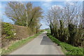
Low Street, Laxfield
Near Sunflower Farm
Road No.D215
Image: © Geographer
Taken: 8 Apr 2017
0.21 miles
4
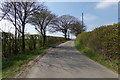
Low Street, Laxfield
Near Sunflower Farm
Road No.C215
Image: © Geographer
Taken: 8 Apr 2017
0.21 miles
5
Footpath to Mill Road
Off Low Street near Sunflower Farm
Image: © Geographer
Taken: 8 Apr 2017
0.22 miles
6
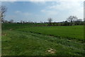
Farmland off Low Street
Near Sunflower Farm
Image: © Geographer
Taken: 8 Apr 2017
0.22 miles
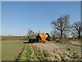
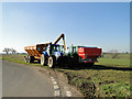
9
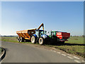
Taking a lunchbreak on the farm
These were spreading fertilizer on the fields before they stopped for a break. The orange trailer was delivering the nitrogen fertilizer to the spreader.
Image: © Adrian S Pye
Taken: 7 Mar 2011
0.22 miles
10
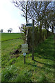
Footpath sign off Low Street
Near Sunflower Farm
Image: © Geographer
Taken: 8 Apr 2017
0.22 miles