
IMAGES TAKEN NEAR TO
Pump Lane, WOODBRIDGE, IP13 8FA
Introduction
This page details the photographs taken nearby to Pump Lane, IP13 8FA by members of the Geograph project.
The Geograph project started in 2005 with the aim of publishing, organising and preserving representative images for every square kilometre of Great Britain, Ireland and the Isle of Man.

There are currently over 7.5m images from over14,400 individuals and you can help contribute to the project by visiting https://www.geograph.org.uk
Image Map
Images are licensed for reuse under creativecommons.org/licenses/by-sa/2.0
Notes
- Clicking on the map will re-center to the selected point.
- The higher the marker number, the further away the image location is from the centre of the postcode.
Image Listing (306 Images Found)
Images are licensed for reuse under creativecommons.org/licenses/by-sa/2.0
Image
Details
Distance
1
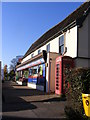
Laxfield Post Office and Laxfield Village Store
Off the B1117 High Street
Image: © Geographer
Taken: 25 Nov 2009
0.03 miles
2
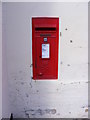
Laxfield Post Office Postbox
Postbox No.IP13 6292
Image: © Geographer
Taken: 1 Sep 2011
0.04 miles
3
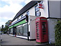
Laxfield Post Office, Telephone & Postbox
Postbox No.IP13 6292
Image: © Geographer
Taken: 1 Sep 2011
0.04 miles
5
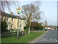
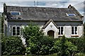
Laxfield Village Sign
The village sign at Laxfield, Suffolk for close up view see http://www.geograph.org.uk/photo/3887026
Image: © Keith Evans
Taken: 13 Mar 2014
0.04 miles
8

Laxfield village sign
The sign has six elements relating to the history of the parish. At the top is what is part of the Wingfield family crest next to that is the church tower and to its right, flames, commemorating the burning at the stake of John Noyes in the village on 22 September 1557.
Two oxen drawing a plough is followed by two horses doing the same signifying the timescale of the agricultural heritage, below is a wavy blue line representing the source of the River Blyth which rises in the parish. That is followed by a railway engine with the dates 1904-1952; the dates the railway arrived and departed.
https://www.geograph.org.uk/photo/6641099
Image: © Adrian S Pye
Taken: 16 Oct 2020
0.04 miles
9
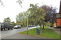
Laxfield village sign
The sign has six elements relating to the history of the parish. At the top is what is part of the Wingfield family crest next to that is the church tower and to its right, flames, commemorating the burning at the stake of John Noyes in the village on 22 September 1557.
Two oxen drawing a plough is followed by two horses doing the same signifying the timescale of the agricultural heritage, below is a wavy blue line representing the source of the River Blyth which rises in the parish. That is followed by a railway engine with the dates 1904-1952; the dates the railway arrived and departed. https://www.geograph.org.uk/photo/6641094
Image: © Adrian S Pye
Taken: 16 Oct 2020
0.04 miles
10

Laxfield, All Saints Church: c15th Seven Sacraments font (detail)
Image: © Michael Garlick
Taken: 29 Jul 2020
0.04 miles