IMAGES TAKEN NEAR TO
Earl Soham, WOODBRIDGE, IP13 7SN
Introduction
This page details the photographs taken nearby to IP13 7SN by members of the Geograph project.
The Geograph project started in 2005 with the aim of publishing, organising and preserving representative images for every square kilometre of Great Britain, Ireland and the Isle of Man.

There are currently over 7.5m images from over14,400 individuals and you can help contribute to the project by visiting https://www.geograph.org.uk
Image Map
Images are licensed for reuse under creativecommons.org/licenses/by-sa/2.0
Notes
- Clicking on the map will re-center to the selected point.
- The higher the marker number, the further away the image location is from the centre of the postcode.
Image Listing (21 Images Found)
Images are licensed for reuse under creativecommons.org/licenses/by-sa/2.0
Image
Details
Distance
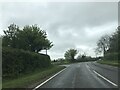

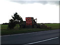
3
Minor road junction on the right to Bedfield on B1120
Image: © Martin Dawes
Taken: 22 Jun 2023
0.05 miles
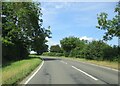
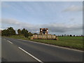
4
Bedfield Road, Saxtead Green
At the junction with the A1120 Several Road
Image: © Geographer
Taken: 1 Sep 2009
0.05 miles

6
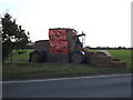
Debenham Young Farmers display
Off the A1120 Several Road
(Close up)
Image: © Geographer
Taken: 17 Oct 2014
0.09 miles
7
Debenham Young Farmers display
Off the A1120 Several Road
http://www.debenhamyoungfarmers.com/
Image: © Geographer
Taken: 17 Oct 2014
0.09 miles
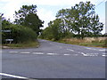
8
A1120 & Debenham Young Farmers display
Off the A1120 Saxtead Road
http://www.debenhamyoungfarmers.com/
Image: © Geographer
Taken: 17 Oct 2014
0.09 miles
9
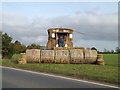
Debenham Young Farmers display
Off the A1120 Saxtead Road
http://www.debenhamyoungfarmers.com/
(close up)
Image: © Geographer
Taken: 17 Oct 2014
0.09 miles
