
IMAGES TAKEN NEAR TO
Charsfield, WOODBRIDGE, IP13 7QA
Introduction
This page details the photographs taken nearby to IP13 7QA by members of the Geograph project.
The Geograph project started in 2005 with the aim of publishing, organising and preserving representative images for every square kilometre of Great Britain, Ireland and the Isle of Man.

There are currently over 7.5m images from over14,400 individuals and you can help contribute to the project by visiting https://www.geograph.org.uk
Image Map
Images are licensed for reuse under creativecommons.org/licenses/by-sa/2.0
Notes
- Clicking on the map will re-center to the selected point.
- The higher the marker number, the further away the image location is from the centre of the postcode.
Image Listing (69 Images Found)
Images are licensed for reuse under creativecommons.org/licenses/by-sa/2.0
Image
Details
Distance
1
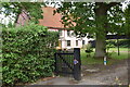
Brook Farmhouse, Charsfield
The farmhouse dates back to the 15th Century and is a Grade II Listed Building. In Victorian times it was two separate cottages, and served as the village Police Station for a time.
Image: © Simon Mortimer
Taken: 17 Jul 2020
0.01 miles
2
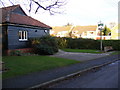
Charsfield Village Sign & Village Hall
On The Street at the junction with St.Peters Close
Image: © Geographer
Taken: 31 Oct 2008
0.03 miles
3
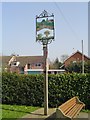
Charsfield village sign
The sign depicts a gated field and the church of St Peter above the name. In the lower section a skep of apples and a sheaf of wheat, reflecting the agricultural and horticultural nature of the village. The crest below the sign is of Sir John Leman, Lord Mayor of London who held his first Court for the manor of Charsfield in 1614. https://www.geograph.org.uk/photo/6747312
Image: © Adrian S Pye
Taken: 2 Apr 2007
0.03 miles
4
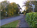
The Street, Charsfield
Looking to the centre of the village at the junction with St.Peters Close
Image: © Geographer
Taken: 31 Oct 2008
0.04 miles
5
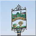
Charsfield village sign
The sign depicts a gated field and the church of St Peter above the name. In the lower section a skep of apples and a sheaf of wheat, reflecting the agricultural and horticultural nature of the village. The crest below the sign is of Sir John Leman, Lord Mayor of London who held his first Court for the manor of Charsfield in 1614. https://www.geograph.org.uk/photo/4291629
Image: © Adrian S Pye
Taken: 16 Dec 2020
0.04 miles
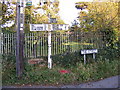
7
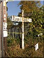
Direction Sign ? Signpost on The Street in Charsfield
Located on the northeast side of the junction of The Street and Hall Road in Charsfield parish. 3 arms and nipple finial. See also https://www.geograph.org.uk/photo/1029675.
Milestone Society National ID: SU_TM2556
Image: © John V Nicholls
Taken: 9 Sep 2011
0.05 miles
8
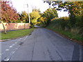
The Street, Charsfield
Looking towards the Charsfield Baptist Church at the junction with St.Peters Close
Image: © Geographer
Taken: 31 Oct 2008
0.05 miles
9
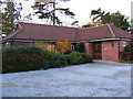
Charsfield Village Hall
On St Peters Close at the junction with The Street.
Image: © Geographer
Taken: 31 Oct 2008
0.05 miles
10
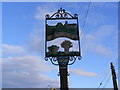
Charsfield Village Sign
On The Street at the junction with St.Peters Close
(Close up)
Image: © Geographer
Taken: 31 Oct 2008
0.05 miles