IMAGES TAKEN NEAR TO
Ipswich Road, WOODBRIDGE, IP13 7PS
Introduction
This page details the photographs taken nearby to Ipswich Road, IP13 7PS by members of the Geograph project.
The Geograph project started in 2005 with the aim of publishing, organising and preserving representative images for every square kilometre of Great Britain, Ireland and the Isle of Man.

There are currently over 7.5m images from over14,400 individuals and you can help contribute to the project by visiting https://www.geograph.org.uk
Image Map
Images are licensed for reuse under creativecommons.org/licenses/by-sa/2.0
Notes
- Clicking on the map will re-center to the selected point.
- The higher the marker number, the further away the image location is from the centre of the postcode.
Image Listing (22 Images Found)
Images are licensed for reuse under creativecommons.org/licenses/by-sa/2.0
Image
Details
Distance
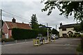
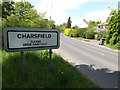
1
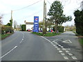
B1078 at Charsfield
Looking towards Bridge Garage
Image: © Geographer
Taken: 17 May 2016
0.12 miles
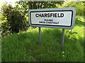
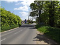
8
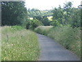
Park Lane (not for traffic) near Charsfield, looking south
Image: © Andrew Hill
Taken: 25 Jun 2008
0.16 miles
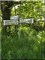
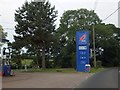
9
Garage And Road Junction
Petrol station and garage on triangular plot of land at the junction of three road near to Charsfield, Suffolk.
Image: © Keith Evans
Taken: 27 Mar 2014
0.17 miles