
IMAGES TAKEN NEAR TO
Church Road, WOODBRIDGE, IP13 7LF
Introduction
This page details the photographs taken nearby to Church Road, IP13 7LF by members of the Geograph project.
The Geograph project started in 2005 with the aim of publishing, organising and preserving representative images for every square kilometre of Great Britain, Ireland and the Isle of Man.

There are currently over 7.5m images from over14,400 individuals and you can help contribute to the project by visiting https://www.geograph.org.uk
Image Map
Images are licensed for reuse under creativecommons.org/licenses/by-sa/2.0
Notes
- Clicking on the map will re-center to the selected point.
- The higher the marker number, the further away the image location is from the centre of the postcode.
Image Listing (133 Images Found)
Images are licensed for reuse under creativecommons.org/licenses/by-sa/2.0
Image
Details
Distance
1
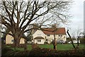
Cottages by the church, Kettleburgh
On the left behind the tree is The Thatched Cottage, early C17 https://www.historicengland.org.uk/listing/the-list/list-entry/1030565 and an annex to Church Cottage https://www.historicengland.org.uk/listing/the-list/list-entry/1199791 in the centre, "probably late C16". You can just see the church tower.
Image: © Derek Harper
Taken: 31 Dec 2016
0.01 miles
2
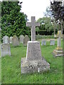
Kettleburgh War Memorial
The granite War Memorial stands beside the path to the south door.
It bears the names of the eleven men lost in WW1 and of three lost in WW2.
A brass memorial on the wall in the church can be seen here > http://www.geograph.org.uk/photo/4619214
Image: © Adrian S Pye
Taken: 17 Aug 2015
0.01 miles
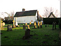
4
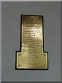
Kettleburgh in-church War Memorial
There is also a stone cross in the churchyard. http://www.geograph.org.uk/photo/4619213
Image: © Adrian S Pye
Taken: 17 Aug 2015
0.02 miles
5
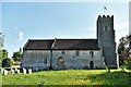
Kettleburgh, St. Andrew's Church: Northern aspect
Image: © Michael Garlick
Taken: 8 May 2020
0.02 miles
6
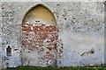
Kettleburgh, St. Andrew's Church: Blocked north doorway to long demolished chapel
The piscina remains.
Image: © Michael Garlick
Taken: 8 May 2020
0.02 miles
7
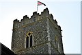
Kettleburgh, St. Andrew's Church: The tower
Image: © Michael Garlick
Taken: 8 May 2020
0.02 miles
8

Church of St. Andrew
https://historicengland.org.uk/listing/the-list/list-entry/1283194?section=official-list-entry
Image: © Sandy Gerrard
Taken: 26 Apr 2025
0.02 miles
9
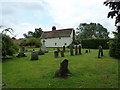
St Andrew, Kettleburgh: looking towards the rectory
Image: © Basher Eyre
Taken: 13 Aug 2010
0.02 miles
10
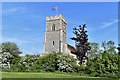
Kettleburgh, St. Andrew's Church: Western aspect
Image: © Michael Garlick
Taken: 8 May 2020
0.02 miles