IMAGES TAKEN NEAR TO
Monk Soham, WOODBRIDGE, IP13 7HB
Introduction
This page details the photographs taken nearby to IP13 7HB by members of the Geograph project.
The Geograph project started in 2005 with the aim of publishing, organising and preserving representative images for every square kilometre of Great Britain, Ireland and the Isle of Man.

There are currently over 7.5m images from over14,400 individuals and you can help contribute to the project by visiting https://www.geograph.org.uk
Image Map
Images are licensed for reuse under creativecommons.org/licenses/by-sa/2.0
Notes
- Clicking on the map will re-center to the selected point.
- The higher the marker number, the further away the image location is from the centre of the postcode.
Image Listing (13 Images Found)
Images are licensed for reuse under creativecommons.org/licenses/by-sa/2.0
Image
Details
Distance
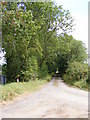
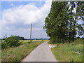
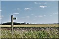
2
Junction to Broadway Farm and Broadway Barn
No longer a working farm but two private dwellings.
Image: © Adrian S Pye
Taken: 4 Mar 2015
0.09 miles
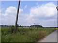
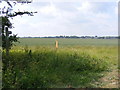
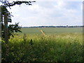
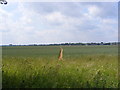
10
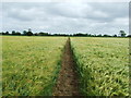
Through The Barley
Footpath through a crop of Barley near to Bedfield, Suffolk.
Image: © Keith Evans
Taken: 20 Jun 2009
0.19 miles