
IMAGES TAKEN NEAR TO
Rookery Road, WOODBRIDGE, IP13 7DD
Introduction
This page details the photographs taken nearby to Rookery Road, IP13 7DD by members of the Geograph project.
The Geograph project started in 2005 with the aim of publishing, organising and preserving representative images for every square kilometre of Great Britain, Ireland and the Isle of Man.

There are currently over 7.5m images from over14,400 individuals and you can help contribute to the project by visiting https://www.geograph.org.uk
Image Map
Images are licensed for reuse under creativecommons.org/licenses/by-sa/2.0
Notes
- Clicking on the map will re-center to the selected point.
- The higher the marker number, the further away the image location is from the centre of the postcode.
Image Listing (55 Images Found)
Images are licensed for reuse under creativecommons.org/licenses/by-sa/2.0
Image
Details
Distance
1
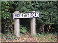
Rookery Road sign
On Rookery Road at the junction with Church Road
Image: © Geographer
Taken: 15 Jun 2011
0.14 miles
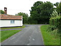
3
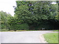
Church Road, Monewden
At the junction with Rookery Road
Image: © Geographer
Taken: 15 Jun 2011
0.16 miles
4
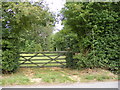
Footpath to Chimer's Farm
Off Rookery Road at the junction with Church Road
Image: © Geographer
Taken: 15 Jun 2011
0.16 miles
5
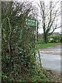
Metal Footpath Sign
Unusual for Suffolk a metal footpath sign giving details of the paths destination. The signs in Suffolk are now always wooden. Seen at Monewden, Suffolk.
Image: © Keith Evans
Taken: 8 Dec 2013
0.16 miles
6
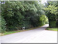
Rookery Road, Monewden
At the junction with Church Road
Image: © Geographer
Taken: 15 Jun 2011
0.17 miles
7
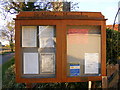
St Mary's Church Notice Board
Off Church Road
Image: © Geographer
Taken: 31 Oct 2008
0.18 miles
8

Telephone Box & Rookery Road Postbox
Postbox No.IP13 6250
Image: © Geographer
Taken: 11 Aug 2011
0.18 miles
9
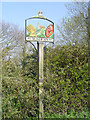
Monewden village sign
The sign is surmounted by a crown and E II R, the dates 1952 and 1977 suggest the sign was erected for the silver jubilee of Queen Elizabeth II. The parish church St Mary is in the centre background with the path drawing the eye to a wheatsheaf representing the agricultural heritage of the village. Opposite, a large cartwheel, a reminder that once a wheelwright, Joshua Shulver and others who may have followed him were outstanding and worthy of inclusion on the village sign.
Image: © Adrian S Pye
Taken: 2 Apr 2007
0.18 miles
10
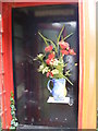
Inside the Telephone Box
Very nice but I see no telephone!
Image: © Geographer
Taken: 11 Aug 2011
0.18 miles