
IMAGES TAKEN NEAR TO
Burgh, WOODBRIDGE, IP13 6SS
Introduction
This page details the photographs taken nearby to IP13 6SS by members of the Geograph project.
The Geograph project started in 2005 with the aim of publishing, organising and preserving representative images for every square kilometre of Great Britain, Ireland and the Isle of Man.

There are currently over 7.5m images from over14,400 individuals and you can help contribute to the project by visiting https://www.geograph.org.uk
Image Map
Images are licensed for reuse under creativecommons.org/licenses/by-sa/2.0
Notes
- Clicking on the map will re-center to the selected point.
- The higher the marker number, the further away the image location is from the centre of the postcode.
Image Listing (10 Images Found)
Images are licensed for reuse under creativecommons.org/licenses/by-sa/2.0
Image
Details
Distance
1
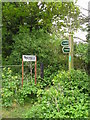
Confusing signs
Some confusion here - one sign says "Private" the other shows a footpath. Taken on the footpath leading up to Debach airfield.
Image: © Chris Holifield
Taken: 14 May 2009
0.02 miles
3
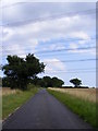
Boulge Road
Near the footpath to Boulge Road
Image: © Geographer
Taken: 28 Jul 2011
0.04 miles
5
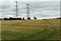
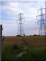
Pylons and ripening barley crop, Burgh
Looking north-east from the road near Hillside Farm.
Image: © Simon Mortimer
Taken: 18 Jul 2020
0.11 miles
6
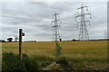
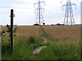
Footpath towards Burgh Farm
Looking south along the public footpath from Boulge Road near Thistleton Lodge.
Image: © Simon Mortimer
Taken: 18 Jul 2020
0.13 miles
7
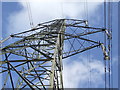
Power Above
The overhead wires and structure of a pylon near to Burgh, Suffolk.
Image: © Keith Evans
Taken: 2 Feb 2014
0.13 miles
9
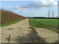
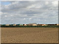
Former Perimeter Track
Looking east along part of the old perimeter track of the former U.S.A.A.F. Debach, Suffolk see http://en.wikipedia.org/wiki/RAF_Debach
Image: © Keith Evans
Taken: 2 Feb 2014
0.19 miles
10
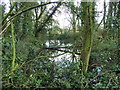
Old Moat
Old moat in small wooded area marked on old O.S. as Thistledown Wood near to Debach, Suffolk. This wood full of moats was once the location of Thistledown Hall. The hall was used by the U.S.A.A.F as it was in the middle of U.S.A.A.F. Debach but was maltreated during it's occupation with most of the interior panelling and staircases being burnt for firewood that the building was only fit for demolition after the war. For info on the airfield see http://en.wikipedia.org/wiki/RAF_Debach
Image: © Keith Evans
Taken: 2 Feb 2014
0.24 miles