IMAGES TAKEN NEAR TO
Otley Road, WOODBRIDGE, IP13 6QQ
Introduction
This page details the photographs taken nearby to Otley Road, IP13 6QQ by members of the Geograph project.
The Geograph project started in 2005 with the aim of publishing, organising and preserving representative images for every square kilometre of Great Britain, Ireland and the Isle of Man.

There are currently over 7.5m images from over14,400 individuals and you can help contribute to the project by visiting https://www.geograph.org.uk
Image Map
Images are licensed for reuse under creativecommons.org/licenses/by-sa/2.0
Notes
- Clicking on the map will re-center to the selected point.
- The higher the marker number, the further away the image location is from the centre of the postcode.
Image Listing (34 Images Found)
Images are licensed for reuse under creativecommons.org/licenses/by-sa/2.0
Image
Details
Distance
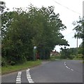
1
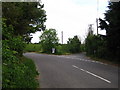
Road junction at Clopton
The B1079 to Otley is to the left, the B1078 to Wickham Market is on the right.
Image: © Chris Holifield
Taken: 15 May 2011
0.07 miles
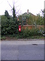
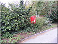
2
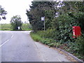
B1079 Grundisburgh Road & Potash Corner Postbox
Postbox No IP13 6215
Image: © Geographer
Taken: 12 Aug 2011
0.07 miles
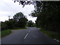
3
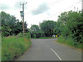
B1078 junction with B1079
The track of the B1078 has deviated south; away from the Roman Road it had overlaid for many miles. There is a shallow valley here formed by the River Lark and the B1079 follows this up from the south. Turning right at this junction the traveller can rejoin the B1078 and the course of the Roman Road a little ways north. Perhaps modern road builders, unlike the Romans, decided to skirt the small hill ascent and follow the contour - thus forming the 'V' shaped deviation?
Image: © Stuart Logan
Taken: 28 Jun 2013
0.08 miles
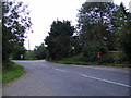
4
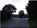
B1079 Grundisburgh Road
At Potash Corner at the junction with the B1078
Image: © Geographer
Taken: 12 Aug 2011
0.08 miles
5
Bus stop, pull-in and post-box on B1079
Near the junction of the B1079 and B1078 between Clopton Green and Clopton
Image: © David Smith
Taken: 19 Jun 2014
0.09 miles
6
B1079 Grundisburgh Road & Potash Corner Postbox
At the junction with the B1078
Postbox No.IP13 6215
Image: © Geographer
Taken: 12 Aug 2011
0.09 miles
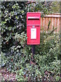
7
Potash Corner Postbox
Postbox No IP13 6215
Image: © Geographer
Taken: 12 Aug 2011
0.09 miles
8
B1079 Grundisburgh Road
Looking towards the B1078 junction taken from Snipe Farm Lane
Image: © Geographer
Taken: 12 Aug 2011
0.09 miles
9
Potash Corner Postbox
Postbox No IP13 6215
Image: © Geographer
Taken: 12 Aug 2011
0.09 miles
10
Potash Corner Postbox
Postbox No IP13 6215
Image: © Geographer
Taken: 12 Aug 2011
0.09 miles