IMAGES TAKEN NEAR TO
Watery Lane, WOODBRIDGE, IP13 6HG
Introduction
This page details the photographs taken nearby to Watery Lane, IP13 6HG by members of the Geograph project.
The Geograph project started in 2005 with the aim of publishing, organising and preserving representative images for every square kilometre of Great Britain, Ireland and the Isle of Man.

There are currently over 7.5m images from over14,400 individuals and you can help contribute to the project by visiting https://www.geograph.org.uk
Image Map
Images are licensed for reuse under creativecommons.org/licenses/by-sa/2.0
Notes
- Clicking on the map will re-center to the selected point.
- The higher the marker number, the further away the image location is from the centre of the postcode.
Image Listing (99 Images Found)
Images are licensed for reuse under creativecommons.org/licenses/by-sa/2.0
Image
Details
Distance
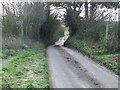
1
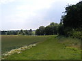
Lake near to the footpath to Hasketon Road & Mill Lane
Off Low Road
Image: © Geographer
Taken: 28 Jul 2011
0.04 miles
2
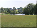
Lake near to the footpath to Hasketon Road & Mill Lane
Off Low Road
Image: © Geographer
Taken: 28 Jul 2011
0.04 miles
3
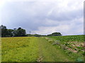
Footpath to Hasketon Road & Mill Lane
Off Low Road
Image: © Geographer
Taken: 28 Jul 2011
0.05 miles
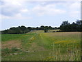
4
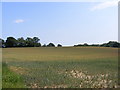
Field near to the footpath to Hasketon Road & Mill Lane
Off Low Road
Image: © Geographer
Taken: 28 Jul 2011
0.05 miles
5

Footpath to Hasketon Road & Mill Lane
Off Low Road
Image: © Geographer
Taken: 28 Jul 2011
0.06 miles
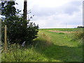
6
Footpath Crossing
Footpath crossing minor road near to Hasketon, Suffolk.
Image: © Keith Evans
Taken: 2 Feb 2014
0.06 miles
7
Footpath to Hasketon Road & Mill Lane
Off Low Road
Image: © Geographer
Taken: 28 Jul 2011
0.06 miles
8

Tractor cultivating the soil ready for drilling (2)
Image: © Adrian S Pye
Taken: 21 Sep 2018
0.06 miles
10
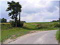
Low Road & the footpath to Hasketon Road & Mill Lane
Image: © Geographer
Taken: 28 Jul 2011
0.07 miles