
IMAGES TAKEN NEAR TO
High Street, WOODBRIDGE, IP13 6EL
Introduction
This page details the photographs taken nearby to High Street, IP13 6EL by members of the Geograph project.
The Geograph project started in 2005 with the aim of publishing, organising and preserving representative images for every square kilometre of Great Britain, Ireland and the Isle of Man.

There are currently over 7.5m images from over14,400 individuals and you can help contribute to the project by visiting https://www.geograph.org.uk
Image Map
Images are licensed for reuse under creativecommons.org/licenses/by-sa/2.0
Notes
- Clicking on the map will re-center to the selected point.
- The higher the marker number, the further away the image location is from the centre of the postcode.
Image Listing (32 Images Found)
Images are licensed for reuse under creativecommons.org/licenses/by-sa/2.0
Image
Details
Distance
1
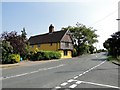
Crown Farmhouse, Ufford
This old Tudor house, dating back to 1590, stands end-on to the road and has a jetty and herringbone brickwork above.
Image: © Adrian S Pye
Taken: 25 Jun 2010
0.01 miles
2
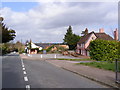
The Crown Public House
On the B1438 High Street
Image: © Geographer
Taken: 16 Apr 2010
0.04 miles
3
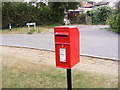
School Lane Postbox
In School Lane
Postbox No. IP13 6214
Image: © Geographer
Taken: 24 Aug 2009
0.04 miles
4
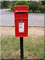
School Lane Postbox
In School Lane
Postbox No. IP13 6214
Image: © Geographer
Taken: 24 Aug 2009
0.04 miles
5
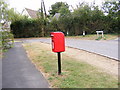
School Lane Postbox
In School Lane
Postbox No.IP13 6214
Image: © Geographer
Taken: 24 Aug 2009
0.04 miles
6

The 'Ufford Crown' in the High Street
http://www.geograph.org.uk/photo/5317415
Image: © Adrian S Pye
Taken: 20 Mar 2017
0.04 miles
7
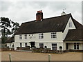
The 'Ufford Crown' public house in the High Street
http://www.geograph.org.uk/photo/5317411
Image: © Adrian S Pye
Taken: 20 Mar 2017
0.05 miles
8
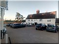
The Ufford Crown pub
Stacked in the car park, some of the bikes from a sponsored cycle ride taking place that evening in aid of the Eve Appeal for gynaecological cancers.
Image: © Christopher Hilton
Taken: 21 Jun 2018
0.05 miles
9
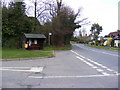
B1438 High Street
Looking towards Ufford at the junction Byng Hall Road
Image: © Geographer
Taken: 16 Apr 2010
0.05 miles
10
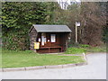
Bus Shelter on Byng Hall Road
At the junction of the B1438 High Street
Image: © Geographer
Taken: 16 Apr 2010
0.06 miles