
IMAGES TAKEN NEAR TO
Rogues Lane, WOODBRIDGE, IP13 0HT
Introduction
This page details the photographs taken nearby to Rogues Lane, IP13 0HT by members of the Geograph project.
The Geograph project started in 2005 with the aim of publishing, organising and preserving representative images for every square kilometre of Great Britain, Ireland and the Isle of Man.

There are currently over 7.5m images from over14,400 individuals and you can help contribute to the project by visiting https://www.geograph.org.uk
Image Map
Images are licensed for reuse under creativecommons.org/licenses/by-sa/2.0
Notes
- Clicking on the map will re-center to the selected point.
- The higher the marker number, the further away the image location is from the centre of the postcode.
Image Listing (89 Images Found)
Images are licensed for reuse under creativecommons.org/licenses/by-sa/2.0
Image
Details
Distance
1
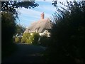
Looking north along Walnuts Lane, Pettistree
Image: © Christopher Hilton
Taken: 5 Sep 2020
0.02 miles
2
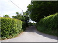
Rogue's Lane, Pettistree
At the junction with Walnuts Lane
Image: © Geographer
Taken: 12 May 2011
0.03 miles
3
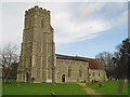
Pettistree St Peter and St Paul?s church
The bulk of the tower on this 15th century church is mainly due to the massive buttresses on the eastern corners. They extend the full width of the nave and more, giving the impression of a pyramid when viewed from the east. The flushwork extends up the buttresses on to a wide band just below the embattled parapet. Although the body of the church has been heavily restored, the contents are quite interesting. Carvings on the bench ends, particularly the poppyheads, are worth close examination. There is a font base dating back to the 13th century and the 16th century font has a pelican feeding its young among the carvings. There are three piscinas in all; the oldest in the chancel is 14th century with a detached column flanking the dropped sill sedilia. 13th century grisaille glass can be seen in the south chancel window.
Image: © Adrian S Pye
Taken: 12 Oct 2010
0.03 miles
4
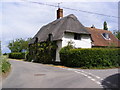
Walnuts Lane, Pettistree
At the junction with Rogue's Lane
Road No.U3420
Image: © Geographer
Taken: 12 May 2011
0.03 miles
5
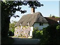
Wisteria Cottage
This beautiful thatched cottage in made splendid by the wisteria in full bloom.
Image: © Adrian S Pye
Taken: 23 May 2010
0.03 miles
6

Flowering wisteria on a cottage in Pettistree village
Image: © Evelyn Simak
Taken: 23 May 2010
0.04 miles
7
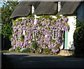
Thatched cottage with flowering wisteria, Pettistree
Image: © Evelyn Simak
Taken: 23 May 2010
0.04 miles
8
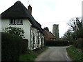
Walnuts Lane
Walnuts Lane Pettistree, Suffolk.
Image: © Keith Evans
Taken: 23 Feb 2014
0.04 miles
9

The church of SS Peter and Paul in Pettistree - churchyard
For a view of the church see > http://www.geograph.org.uk/photo/1880808.
Image: © Evelyn Simak
Taken: 23 May 2010
0.04 miles
10

The church of SS Peter and Paul in Pettistree - font
For an exterior view of the church see > http://www.geograph.org.uk/photo/1880808.
Image: © Evelyn Simak
Taken: 23 May 2010
0.05 miles