IMAGES TAKEN NEAR TO
Barrows Close, IP13 0FE
Introduction
This page details the photographs taken nearby to Barrows Close, IP13 0FE by members of the Geograph project.
The Geograph project started in 2005 with the aim of publishing, organising and preserving representative images for every square kilometre of Great Britain, Ireland and the Isle of Man.

There are currently over 7.5m images from over14,400 individuals and you can help contribute to the project by visiting https://www.geograph.org.uk
Image Map
Images are licensed for reuse under creativecommons.org/licenses/by-sa/2.0
Notes
- Clicking on the map will re-center to the selected point.
- The higher the marker number, the further away the image location is from the centre of the postcode.
Image Listing (34 Images Found)
Images are licensed for reuse under creativecommons.org/licenses/by-sa/2.0
Image
Details
Distance
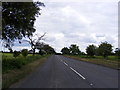
1
Wickham Market Rogues Lane
Wickham Market Rogues Lane
Image: © Cud05
Taken: 28 May 2016
0.05 miles
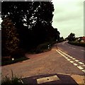
2
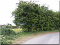
B1438 Yarmouth Road
Looking towards Ufford at the junction with Rogue's Lane
Image: © Geographer
Taken: 12 May 2011
0.06 miles
3
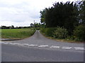
Rogue's Lane, Pettistree
At the junction with the B1438 Main Street
Road No.U3428
Image: © Geographer
Taken: 12 May 2011
0.06 miles
4
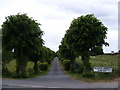
Wickham Market Cemetery
Off the B1438 Main Road
Image: © Geographer
Taken: 12 May 2011
0.13 miles
5
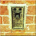
Flush Bracket G 1576 Wickham Market Old School House
Flush Bracket OSBM G 1576. E face, SE angle of school.
Image: © Cud05
Taken: 28 May 2016
0.17 miles
6
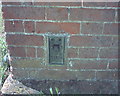
OS Flush Bracket G1576 Wickham Market
Wickham Market.
www.bench-marks.org.uk/bm10669
Image: © Richard Neale
Taken: 1 Nov 2001
0.17 miles
7
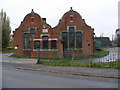
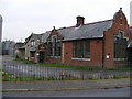
The Old School, Wickham Market
Off the B1438 High Street
Image: © Geographer
Taken: 5 Nov 2008
0.18 miles
9
The Old School, Wickham Market
Off the B1438 High Street
Image: © Geographer
Taken: 5 Nov 2008
0.18 miles
10
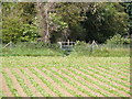
Footpath to St.Peter & St.Paul's Church & Walnuts Lane
Off the B1438 Yarmouth Road
Image: © Geographer
Taken: 12 May 2011
0.21 miles