IMAGES TAKEN NEAR TO
Framlingham Road, WOODBRIDGE, IP13 0EP
Introduction
This page details the photographs taken nearby to Framlingham Road, IP13 0EP by members of the Geograph project.
The Geograph project started in 2005 with the aim of publishing, organising and preserving representative images for every square kilometre of Great Britain, Ireland and the Isle of Man.

There are currently over 7.5m images from over14,400 individuals and you can help contribute to the project by visiting https://www.geograph.org.uk
Image Map
Images are licensed for reuse under creativecommons.org/licenses/by-sa/2.0
Notes
- Clicking on the map will re-center to the selected point.
- The higher the marker number, the further away the image location is from the centre of the postcode.
Image Listing (4 Images Found)
Images are licensed for reuse under creativecommons.org/licenses/by-sa/2.0
Image
Details
Distance

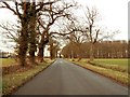
3
Dark Lane
Looking towards the B1116 Woodbridge Road
Road No.C237
Image: © Geographer
Taken: 13 Jul 2010
0.04 miles
4
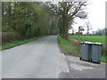
Bin Day
Wheelie bins out for collection near to Kettleburgh, Suffolk.
Image: © Keith Evans
Taken: 27 Mar 2014
0.25 miles