
IMAGES TAKEN NEAR TO
The Street, WOODBRIDGE, IP13 0EE
Introduction
This page details the photographs taken nearby to The Street, IP13 0EE by members of the Geograph project.
The Geograph project started in 2005 with the aim of publishing, organising and preserving representative images for every square kilometre of Great Britain, Ireland and the Isle of Man.

There are currently over 7.5m images from over14,400 individuals and you can help contribute to the project by visiting https://www.geograph.org.uk
Image Map
Images are licensed for reuse under creativecommons.org/licenses/by-sa/2.0
Notes
- Clicking on the map will re-center to the selected point.
- The higher the marker number, the further away the image location is from the centre of the postcode.
Image Listing (121 Images Found)
Images are licensed for reuse under creativecommons.org/licenses/by-sa/2.0
Image
Details
Distance
1
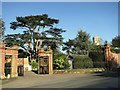
Original entrance gates to Easton Manor house, Easton
The village is mentioned in the Domesday Book and was linked to the manor of Martley until 1627, when Sir Anthony Wingfield made the 150 acre estate his home. In 1688 Easton was purchased by the Prince of Orange for the Earl of Rochford. The 5th Earl made many improvements before he died in 1830. These included surrounding the Easton Estate and house with its famous crinkle-crankle wall which is believed to be the longest example of this form of wall construction and design. When Easton Hall, the seat of the Duke and Duchess of Hamilton, was demolished and transported to the USA in the 1920s, to be re-assembled as a ranch, the estate's crinkle crankle boundary wall running alongside the road to All Saints Church remained as a fragmentary remnant of the previous estate.
Image: © Evelyn Simak
Taken: 16 Jan 2012
0.01 miles
2

The crinkle-crankle wall of Easton
A wavy wall marks the boundary of the former Easton Hall estate along the Street in Easton. This form of construction makes for a stronger - and possibly more economical - wall than one which is straight. Judging from the EU flag it seems probable that someone in the locality is not very happy about Brexit.
Image: © Oliver Dixon
Taken: 25 Apr 2017
0.01 miles
3
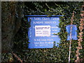
All Saints Church Notice Board
Off The Street
Image: © Geographer
Taken: 31 Oct 2008
0.02 miles
4
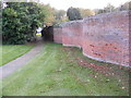
The entrance to All Saints Church and the wiggly wall
Off The Street
Image: © Geographer
Taken: 31 Oct 2008
0.02 miles
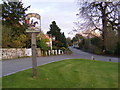
7
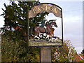
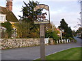
Easton Village Sign
Off The Street
(Close up)
Image: © Geographer
Taken: 31 Oct 2008
0.03 miles
8
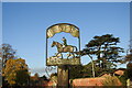
Easton village sign
The sign depicts a rider and hounds on a hunt.
Easton is still home to the pack of hunting hounds established by the 12th Duke in the 19th century. The pack of harriers was established and funded entirely by the duke, much to the delight of the local landowners and farmers. After many years and change of public opinion the hunt is now called the Easton Harriers and is still an integral part of the village, and shows good sport in the local area.
Image: © Adrian S Pye
Taken: 22 Oct 2020
0.03 miles
9
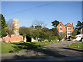
Cottages and All Saints church, Easton
Image: © Evelyn Simak
Taken: 16 Jan 2012
0.04 miles
10
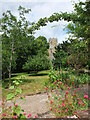
Easton church tower
Taken on Easton Open Gardens Day 2022
Image: © Chris Holifield
Taken: 3 Jul 2022
0.04 miles