
IMAGES TAKEN NEAR TO
Boyton, WOODBRIDGE, IP12 3LG
Introduction
This page details the photographs taken nearby to IP12 3LG by members of the Geograph project.
The Geograph project started in 2005 with the aim of publishing, organising and preserving representative images for every square kilometre of Great Britain, Ireland and the Isle of Man.

There are currently over 7.5m images from over14,400 individuals and you can help contribute to the project by visiting https://www.geograph.org.uk
Image Map
Images are licensed for reuse under creativecommons.org/licenses/by-sa/2.0
Notes
- Clicking on the map will re-center to the selected point.
- The higher the marker number, the further away the image location is from the centre of the postcode.
Image Listing (14 Images Found)
Images are licensed for reuse under creativecommons.org/licenses/by-sa/2.0
Image
Details
Distance
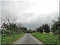
2
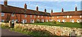
Boyton: the Mary Warner almshouses
Image: © Christopher Hilton
Taken: 20 Dec 2023
0.15 miles
3
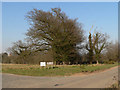
Trees and Almshouses sign
Trees with a jackdaw roost and sign to the Mary Warner homes
Image: © Richard Mudhar
Taken: 25 Mar 2007
0.15 miles
5
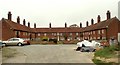
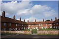
The Mary Warner Almshouses
These almshouses stand just west of Boyton parish church. The original middle range was built in 1736. The left wing was added in 1828 and the opposite wing was built in 1860. Mary Warner was a member of a well known Suffolk family that owned much land in these parts and she had made provision in her will that these almshouses were to be built to house six poor women and six poor men who were to be given a yearly allowance of 50 shillings.
Image: © Robert Edwards
Taken: 12 Oct 2007
0.15 miles
6
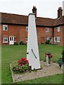
Boxed in village pump at Boyton Almshouses
Image: © Adrian S Pye
Taken: 30 Aug 2015
0.16 miles
7
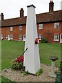
Boxed-in village pump at Boyton Almshouses with firebell
Image: © Adrian S Pye
Taken: 30 Aug 2015
0.16 miles
8
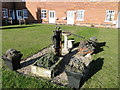
The water pump at the Mary Warner Almshouses, Boyton
Until recently the pump was enclosed. viz http://www.geograph.org.uk/photo/4637494 http://www.geograph.org.uk/photo/4637497
Image: © Adrian S Pye
Taken: 19 Nov 2016
0.16 miles
9
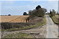
The lane towards Boyton
Looking east from the crossroads just above Valley Farm.
Image: © Simon Mortimer
Taken: 9 Mar 2019
0.17 miles
10
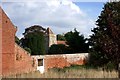
Boyton church from the south west
Viewed over the wall of the Mary Warner Almshouses adjacent to the churchyard.
Image: © Simon Mortimer
Taken: 15 Oct 2016
0.18 miles