IMAGES TAKEN NEAR TO
Woodbridge Walk, WOODBRIDGE, IP12 3LA
Introduction
This page details the photographs taken nearby to Woodbridge Walk, IP12 3LA by members of the Geograph project.
The Geograph project started in 2005 with the aim of publishing, organising and preserving representative images for every square kilometre of Great Britain, Ireland and the Isle of Man.

There are currently over 7.5m images from over14,400 individuals and you can help contribute to the project by visiting https://www.geograph.org.uk
Image Map
Images are licensed for reuse under creativecommons.org/licenses/by-sa/2.0
Notes
- Clicking on the map will re-center to the selected point.
- The higher the marker number, the further away the image location is from the centre of the postcode.
Image Listing (18 Images Found)
Images are licensed for reuse under creativecommons.org/licenses/by-sa/2.0
Image
Details
Distance
1
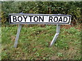
Boyton Road sign
At the Stores Corner Crossroads
Image: © Geographer
Taken: 22 Sep 2011
0.09 miles
2
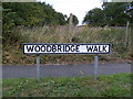
Woodbridge Walk sign
At the Stores Corner Crossroads
Image: © Geographer
Taken: 22 Sep 2011
0.09 miles
3
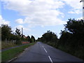
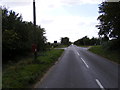
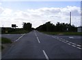
Woodbridge Walk at Stores Corner Crossroads
Image: © Geographer
Taken: 22 Sep 2011
0.10 miles
4
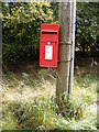
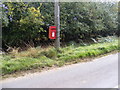
Stores Corner Postbox
Postbox No.IP12 6328
Image: © Geographer
Taken: 22 Sep 2011
0.11 miles
5
Boyton Road & Stores Corner Postbox
in the distance is the Stores Corner Crossroads
Postbox No.IP12 6328
Image: © Geographer
Taken: 22 Sep 2011
0.11 miles
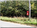
6
Stores Corner Postbox
Postbox No.IP12 6328
Image: © Geographer
Taken: 22 Sep 2011
0.11 miles
7
Stores Corner Postbox
Postbox No.IP12 6328
Image: © Geographer
Taken: 22 Sep 2011
0.11 miles
8
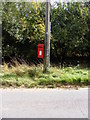
Stores Corner Postbox
Postbox No.IP12 6328
Image: © Geographer
Taken: 22 Sep 2011
0.11 miles
9
Boyton Road at Stores Corner Crossroads
At the junction with Melton Road & Woodbridge Walk
Image: © Geographer
Taken: 22 Sep 2011
0.12 miles
10
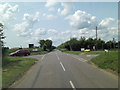
Boyton Road junction with Woodbridge Walk
On the right of the crossroads is Melton Road.
Image: © Stuart Logan
Taken: 24 Jun 2013
0.12 miles