IMAGES TAKEN NEAR TO
Main Road, WOODBRIDGE, IP12 3EE
Introduction
This page details the photographs taken nearby to Main Road, IP12 3EE by members of the Geograph project.
The Geograph project started in 2005 with the aim of publishing, organising and preserving representative images for every square kilometre of Great Britain, Ireland and the Isle of Man.

There are currently over 7.5m images from over14,400 individuals and you can help contribute to the project by visiting https://www.geograph.org.uk
Image Map
Images are licensed for reuse under creativecommons.org/licenses/by-sa/2.0
Notes
- Clicking on the map will re-center to the selected point.
- The higher the marker number, the further away the image location is from the centre of the postcode.
Image Listing (11 Images Found)
Images are licensed for reuse under creativecommons.org/licenses/by-sa/2.0
Image
Details
Distance
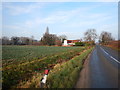
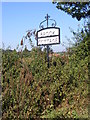
1
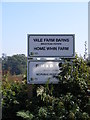
Vale Farm Barns & Home Whin Farm sign
Off the B1083 Woodbridge Road
Image: © Geographer
Taken: 29 Sep 2011
0.00 miles
3
Entrance to Vale Farm Barns & Home Whin Farm
Off the B1083 Woodbridge Road
Image: © Geographer
Taken: 29 Sep 2011
0.02 miles
4
Entrance to Vale Farm Barns & Home Whin Farm
Off the B1083 Woodbridge Road
Image: © Geographer
Taken: 29 Sep 2011
0.02 miles
5
Entrance to Vale Farm Barns & Home Whin Farm
Off the B1083 Woodbridge Road
Image: © Geographer
Taken: 29 Sep 2011
0.03 miles
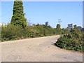
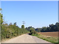
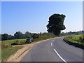
6
Minor Road to Melton
Close to Woodhall Wood and Loam Ponds.
Image: © James Emmans
Taken: 16 Dec 2016
0.04 miles
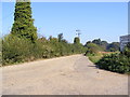
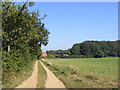
7
Farm track from Vale Farm
Towards the B1083 between Shottisham and Sutton.
Image: © Andrew Hill
Taken: 16 Dec 2009
0.16 miles
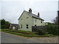
8
The Entrance to Brook Cottage
Off the B1083 Woodbridge Road
Image: © Geographer
Taken: 29 Sep 2011
0.18 miles
9
Brook Farm sign
Off the B1083 Alderton Road
Image: © Geographer
Taken: 29 Sep 2011
0.18 miles
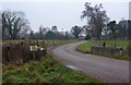
10
B1083 Woodbridge Road & the entrance to Brook Cottage
Image: © Geographer
Taken: 29 Sep 2011
0.18 miles