1
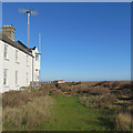
Former coastguard cottages, Shingle Street
Image: © Jonathan Thacker
Taken: 13 May 2022
0.00 miles
2
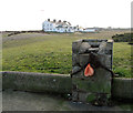
Coastguard cottages, Shingle Street
Image: © Oxymoron
Taken: 18 Jan 2009
0.01 miles
3
Shingle Street: past the former coastguard cottages
The Suffolk Coastal Path comes this way. The photograph was taken just before noon on a picture-perfect Christmas Day.
Image: © John Sutton
Taken: 25 Dec 2019
0.01 miles
4
Coastguard cottages
Looking across the shingle to the appropriately named hamlet of Shingle Street.
Image: © DS Pugh
Taken: 30 Jul 2012
0.01 miles
5
Shingle Street: cottages on Christmas Day
From left to right, German Ocean Mansion, the former coastguard cottages and - in
Image - The Beacon.
Image: © John Sutton
Taken: 25 Dec 2019
0.01 miles
6
Shingle Street - Coastguard Cottages
Image: © Colin Park
Taken: 26 Sep 2016
0.01 miles
7
Coastguard cottages at Shingle Street
The coastguard cottages date back to Victorian times and provided accommodation for married staff. The single men lived in the single storey block next door, before it was converted to lodging houses in the 1870s.
Image: © Simon Mortimer
Taken: 17 Jul 2020
0.01 miles
8
Coastguard Cottages, Shingle Street
Shingle Street is situated at the mouth of Orford Ness and is also known as Hollesley Bay. Originally the hamlet was inhabited by fishermen and river pilots for the River Ore. The 19th century Martello tower, one of several in the area, was converted to dwellings for members of the coastguards. A number of buildings were destroyed during World War II, including the Lifeboat Inn, the hamlet's only pub. A report dating from October 2004 suggests that Shingle Street is at risk from the sea and could disappear within 20 years if sea defences are not erected.
After World War II rumours arose that a failed German invasion had occurred at Shingle Street. Since the civilian population had been evacuated in May 1940 there were no eyewitness reports and official documents remained classified until questions in the House of Commons led to their early release in 1993. The papers disclosed no German landing, but did reveal that the Lifeboat Inn had been used to test an uncharged chemical bomb devised by Porton Down.
For a detailed history read: http://en.wikipedia.org/wiki/Shingle_Street
Image: © Evelyn Simak
Taken: 29 Jan 2012
0.02 miles
9
Coastguard Cottages, Shingle Street
Shingle Street is situated at the mouth of Orford Ness and is also known as Hollesley Bay. Originally the hamlet was inhabited by fishermen and river pilots for the River Ore. The 19th century Martello tower, one of several in the area, was converted to dwellings for members of the coastguards. A number of buildings were destroyed during World War II, including the Lifeboat Inn, the hamlet's only pub. A report dating from October 2004 suggests that Shingle Street is at risk from the sea and could disappear within 20 years if sea defences are not erected.
After World War II rumours arose that a failed German invasion had occurred at Shingle Street. Since the civilian population had been evacuated in May 1940 there were no eyewitness reports and official documents remained classified until questions in the House of Commons led to their early release in 1993. The papers disclosed no German landing, but did reveal that the Lifeboat Inn had been used to test an uncharged chemical bomb devised by Porton Down.
For a detailed history read: http://en.wikipedia.org/wiki/Shingle_Street
Image: © Evelyn Simak
Taken: 29 Jan 2012
0.02 miles
10
Shingle Street, Suffolk
Coastguard cottages at Shingle Street.
Image: © Rebecca A Wills
Taken: 12 Jun 2021
0.02 miles


