IMAGES TAKEN NEAR TO
Hollesley Road, WOODBRIDGE, IP12 2RU
Introduction
This page details the photographs taken nearby to Hollesley Road, IP12 2RU by members of the Geograph project.
The Geograph project started in 2005 with the aim of publishing, organising and preserving representative images for every square kilometre of Great Britain, Ireland and the Isle of Man.

There are currently over 7.5m images from over14,400 individuals and you can help contribute to the project by visiting https://www.geograph.org.uk
Image Map
Images are licensed for reuse under creativecommons.org/licenses/by-sa/2.0
Notes
- Clicking on the map will re-center to the selected point.
- The higher the marker number, the further away the image location is from the centre of the postcode.
Image Listing (19 Images Found)
Images are licensed for reuse under creativecommons.org/licenses/by-sa/2.0
Image
Details
Distance
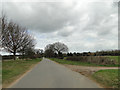
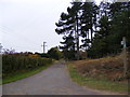
1
Sandy Lane on the left and a sandy lane on the right
Image: © Adrian S Pye
Taken: 1 Apr 2015
0.01 miles
2
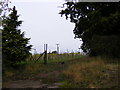
Footpath to Church Lane, Eyke
Off Hollesley Road
Image: © Geographer
Taken: 27 Oct 2011
0.01 miles
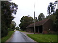
3
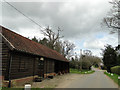
Old farm building and cartshed opposite Old Rookery House
Image: © Adrian S Pye
Taken: 1 Apr 2015
0.03 miles
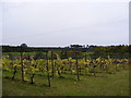
4
Hollesley Road & the Staverton Vineyard Sales Building
Image: © Geographer
Taken: 27 Oct 2011
0.06 miles

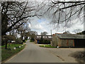
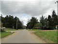
7
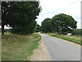
Hollesley Road
Looking north along Hollesley Road near to Eyke, Suffolk.
Image: © Keith Evans
Taken: 21 Aug 2014
0.13 miles