
IMAGES TAKEN NEAR TO
Street Farm Close, WOODBRIDGE, IP12 2LD
Introduction
This page details the photographs taken nearby to Street Farm Close, IP12 2LD by members of the Geograph project.
The Geograph project started in 2005 with the aim of publishing, organising and preserving representative images for every square kilometre of Great Britain, Ireland and the Isle of Man.

There are currently over 7.5m images from over14,400 individuals and you can help contribute to the project by visiting https://www.geograph.org.uk
Image Map
Images are licensed for reuse under creativecommons.org/licenses/by-sa/2.0
Notes
- Clicking on the map will re-center to the selected point.
- The higher the marker number, the further away the image location is from the centre of the postcode.
Image Listing (70 Images Found)
Images are licensed for reuse under creativecommons.org/licenses/by-sa/2.0
Image
Details
Distance
1

Tunstall village sign
Tunstall is almost all Forest consisting of coniferous plantations, broadleaved belts and heathland areas which link up with both Tunstall and Blaxhall Common. These areas are great for ground nesting birds such as the Nightjar and Woodlark. It is part of the Suffolk Coasts and Heaths Area of Outstanding Natural Beauty. https://www.geograph.org.uk/photo/6648873
Image: © Adrian S Pye
Taken: 22 Oct 2020
0.04 miles
2
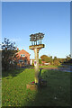
Tunstall village sign
See a close up and more about the sign here https://www.geograph.org.uk/photo/6648638
Image: © Adrian S Pye
Taken: 22 Oct 2020
0.04 miles
3
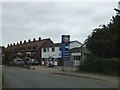
Gulf filling station, Tunstall
It is also a vehicle testing station, and offers "Servicing, tyres and vehicle sales"
Image: © David Smith
Taken: 15 Jun 2014
0.05 miles
4
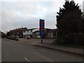
Stephen Caulfield & Son
Off the B1078 Ash Road
Image: © Geographer
Taken: 20 Nov 2014
0.06 miles
5
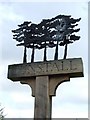
Tunstall village sign
Close up of Tunstall village sign Tunstall Suffolk for overall view see http://www.geograph.org.uk/photo/936330
Image: © Keith Evans
Taken: 24 Aug 2008
0.06 miles
6
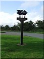
Tunstall village sign
Tunstall village sign Tunstall Suffolk for close up view see http://www.geograph.org.uk/photo/936328
Image: © Keith Evans
Taken: 24 Aug 2008
0.06 miles
7
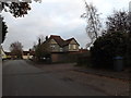
B1078 Ash Road, Tunstall
At the entrance to Tunstall Community Centre
Image: © Geographer
Taken: 20 Nov 2014
0.07 miles
8
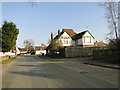
The back of the Green Man public house at Tunstall
Taken from the B1078 Ashe Road with the junction with the B1069 just ahead..
Image: © Adrian S Pye
Taken: 4 Mar 2011
0.07 miles
9
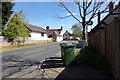
B1078 Ash Road, Tunstall
At the entrance to Tunstall Village Hall
Image: © Geographer
Taken: 11 Apr 2017
0.07 miles
10
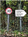
Roadsign & Tunstall Community Centre sign
At the entrance to Tunstall Community Centre off the B1078 Ash Road
Image: © Geographer
Taken: 20 Nov 2014
0.07 miles