IMAGES TAKEN NEAR TO
Woodbridge Road, WOODBRIDGE, IP12 2JE
Introduction
This page details the photographs taken nearby to Woodbridge Road, IP12 2JE by members of the Geograph project.
The Geograph project started in 2005 with the aim of publishing, organising and preserving representative images for every square kilometre of Great Britain, Ireland and the Isle of Man.

There are currently over 7.5m images from over14,400 individuals and you can help contribute to the project by visiting https://www.geograph.org.uk
Image Map
Images are licensed for reuse under creativecommons.org/licenses/by-sa/2.0
Notes
- Clicking on the map will re-center to the selected point.
- The higher the marker number, the further away the image location is from the centre of the postcode.
Image Listing (74 Images Found)
Images are licensed for reuse under creativecommons.org/licenses/by-sa/2.0
Image
Details
Distance
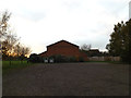
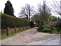
1
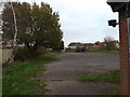
Woodbridge Road, Tunstall
The junction with Longmans Lane, now a footpath. The properties beyond show three different boundary markers: wall, hedge and fence
Image: © David Smith
Taken: 18 Jun 2014
0.01 miles
2
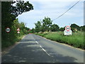
Entering Tunstall
Entering the village of Tunstall, Suffolk on the B1069.
Image: © Keith Evans
Taken: 3 Jul 2014
0.01 miles
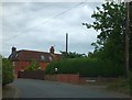
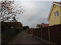
3
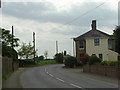
House on the bend of Woodbridge Road, Tunstall
Looking South West. Public footpath sign to the left.
Image: © Claire Haystead
Taken: 6 May 2007
0.01 miles
4
Longmans Lane footpath to Bentwaters Airfield Enterprise Park
Off the B1069 Woodbridge Road
Image: © Geographer
Taken: 11 Apr 2011
0.01 miles
5
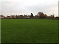
Tunstall Playing Field
At Tunstall Community Centre
Image: © Geographer
Taken: 20 Nov 2014
0.03 miles
6
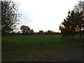
Tunstall Playing Field
At Tunstall Community Centre
Image: © Geographer
Taken: 20 Nov 2014
0.04 miles
7
Accident Repair Centre in Tunstall
The office has a wind-vane showing the outline of a classic car.
Image: © David Smith
Taken: 18 Jun 2014
0.04 miles
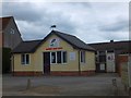
9
Entrance of Tunstall Community Centre
Looking towards the B1078 Ash Road
Image: © Geographer
Taken: 20 Nov 2014
0.05 miles