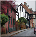
IMAGES TAKEN NEAR TO
Lanyard Place, WOODBRIDGE, IP12 1FE

Introduction

This page details the photographs taken nearby to Lanyard Place, IP12 1FE by members of the Geograph project.

The Geograph project started in 2005 with the aim of publishing, organising and preserving representative images for every square kilometre of Great Britain, Ireland and the Isle of Man.

There are currently over 7.5m images from over14,400 individuals and you can help contribute to the project by visiting https://www.geograph.org.uk

Image Map


Images are licensed for reuse under creativecommons.org/licenses/by-sa/2.0
Notes
  • Clicking on the map will re-center to the selected point.
  • The higher the marker number, the further away the image location is from the centre of the postcode.

Image Listing (740 Images Found)

Images are licensed for reuse under creativecommons.org/licenses/by-sa/2.0
  • ...
Image
Details
Distance
1
Woodbridge Library
Off the B1079 New Street
Image: © Geographer Taken: 15 Sep 2011
0.02 miles
2
New Street, Woodbridge
Image: © Jim Osley Taken: 1 Apr 2015
0.04 miles
3
Woodbridge Library sign
Off the B1079 New Street
Image: © Geographer Taken: 15 Sep 2011
0.04 miles
4
Thoroughfare- items hanging up outside a shop
Image: © Basher Eyre Taken: 9 Aug 2010
0.04 miles
5
Mariner's Arms
Presently called The Old Mariner. http://www.suffolkcamra.co.uk/pubs/pub/1033
Image: © Tim Marchant Taken: 1 Apr 2009
0.04 miles
6
Commemorative stone in New Street
Image: © Basher Eyre Taken: 9 Aug 2010
0.04 miles
7
Towards the bottom of New Street
A delightful street
Image: © Andrew Hill Taken: 28 Feb 2009
0.04 miles
8
New Street, Woodbridge
1656: The Advice, a warship built at Woodbridge, took part in the victory over the Dutch at the battle of Sole Bay, off Southwold. 146 prisoners were kept in a timber-framed building in New Street, which is now a private house called the Bridewell.This is the red painted building in this picture.
Image: © Chris Gunns Taken: 20 Nov 2009
0.04 miles
9
The Old Bell and Steelyard, New Street, Woodbridge.
From the pub website. What is a Steelyard? In times gone by it was used to weigh carts when the government of the time passed a Road Traffic Act. This was because carts were getting heavier and the steel banded wheels were becoming much thinner and damaging the road surface. The new act stated that a toll had to be paid if loads were over 2.5 tons. Local records suggest that the Steelyard was added to the original building somewhere around 1680. This steelyard was last used commercially in the 1880s. It was dismantled in 1897 and taken to London for a Victorian exhibition before being reinstated. A working model of this very steelyard can be seen in the Science Museum in London and also in the Avery Museum. Technical data... The load capacity is 3 tons (imperial). Main beam is 13feet long and mainly forged from iron. The counterweight weighed 108lbs and was made of lead. Steelyards died out as modern drive on / drive off weighbridges were invented. This steelyard is 1 of only two complete steelyards left in the country, the second is in Soham near Cambridge which is said to have raised an elephant in the 1880s.
Image: © Chris Gunns Taken: 20 Nov 2009
0.04 miles
10
The Thoroughfare, Woodbridge
The main shopping street in Woodbridge
Image: © Claire Haystead Taken: 11 May 2007
0.04 miles
  • ...