IMAGES TAKEN NEAR TO
Princes Street, IPSWICH, IP1 1SB
Introduction
This page details the photographs taken nearby to Princes Street, IP1 1SB by members of the Geograph project.
The Geograph project started in 2005 with the aim of publishing, organising and preserving representative images for every square kilometre of Great Britain, Ireland and the Isle of Man.

There are currently over 7.5m images from over14,400 individuals and you can help contribute to the project by visiting https://www.geograph.org.uk
Image Map
Images are licensed for reuse under creativecommons.org/licenses/by-sa/2.0
Notes
- Clicking on the map will re-center to the selected point.
- The higher the marker number, the further away the image location is from the centre of the postcode.
Image Listing (441 Images Found)
Images are licensed for reuse under creativecommons.org/licenses/by-sa/2.0
Image
Details
Distance
1
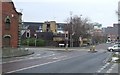
Check the difference
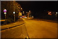
Compare Princes Street Ipswich Suffolk with the photo from 1982 by Martin Addison http://www.geograph.org.uk/photo/664206
Image: © Keith Evans
Taken: 7 Jan 2009
0.01 miles
2
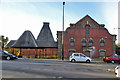
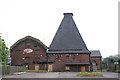
Former Paul's maltings and kiln, Ipswich
A grade II listed building, recently used as a club, but all shuttered up at the time of this view.
Image: © Robin Webster
Taken: 19 Nov 2017
0.01 miles
3
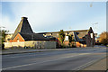
Former Paul's maltings and kiln, Ipswich
A grade II listed building, recently used as a club, but all shuttered up at the time of this view.
Image: © Robin Webster
Taken: 19 Nov 2017
0.01 miles
5
Princes Street
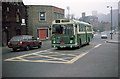
Borough of Ipswich No.118, a Bristol RE, travels along Princes Street towards Ipswich station. This area has seen significant redevelopment since this photo was taken. The closest building - Paul's Maltings remains, but the more modern building beyond has been demolished as the road layout was changed. Commercial road now crosses Princes Street and the road in the foreground acts as a sliproad. Behind the bus, there is now a fire station. Further down the road, the office building with the clock, which stands on the corner of Portman Road still exists, but the adjacent building, once the offices of John player tobacco, has been converted to housing. Above the bus is one of the floodlights at Portman Road, Ipswich FC's ground. These observations made by careful study of Google maps and information from local resident and amateur historian Stu List.
Image: © Martin Addison
Taken: Unknown
0.01 miles
9
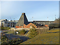
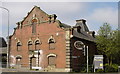
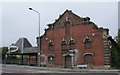
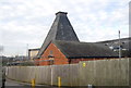
Former Paul's maltings and kiln, Ipswich
A grade II listed building, recently used as a club, but all shuttered up at the time of this view.
Image: © Robin Webster
Taken: 19 Nov 2017
0.02 miles