1
St John's Vicarage
A very sad looking, but very fine house, the vicarage of St John's Church.
Image: © Tim Marchant
Taken: 26 May 2009
0.14 miles
2
Felixstowe St John the Baptist?s church
This is a traditional church by comparison to St Andrew’s and was designed by Sir Arthur Blomfield in 1894. It is stark in appearance, being constructed of red brick, but it is well proportioned and has a pleasing façade. The south-west tower is square and pinnacled with a contrasting elegant white stone spire and weathers on the buttressing. The interior is also in red brick and is well complemented by fine woodwork.
Image: © Adrian S Pye
Taken: 5 Nov 2007
0.14 miles
3
Battlefield Cross at Felixstowe
The Cross is in a case at St Peter and St Paul's church in Felixstowe.
It is the original burial cross of Captain W.H.M. Kersey before a permanent headstone was erected.
William Henry Myddleton Kersey was killed 17 October 1917.
He served with 166 Siege Battery of the Royal Garrison Artillery.
He was 25 years old.
He is buried at The Huts Cemetery along with 1,094 others, he was the son of William Edward and Ada Laura Kersey, of Felixstowe.
Image: © Adrian S Pye
Taken: 24 Sep 2020
0.15 miles
4
War Memorial outside St John's church, Felixstowe
The memorial is in addition to the one at Undercliff, on the sea front.
More by design than fact there are 29 names for each of the two World Wars. The figures seem to be just representative. The true figures for the town are nearer 163 + for The Great War & 111 + for The Second World War.
Image: © Adrian S Pye
Taken: 21 Aug 2016
0.15 miles
5
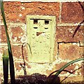
OS Flush Bracket 2112 Felixstowe
Felixstowe, St John The Baptist Church.
www.bench-marks.org.uk/bm1327
Image: © Richard Neale
Taken: 1 Nov 2001
0.15 miles
6
Flush Bracket OSBM 2112 Felixstowe St John the Baptist Church
Flush Bracket OSBM 2112 Felixstowe St John the Baptist Church, S face.
Image: © Cud05
Taken: 11 Apr 2016
0.15 miles
7
St John's Church, Felixstowe
The principal Anglican church of Felixstowe.
http://www.suffolkchurches.co.uk/felixjohn.htm
Image: © Tim Marchant
Taken: 26 May 2009
0.16 miles
8
Deben High school site, Garrison Lane, Felixstowe
Demolished in 2021.
Image: © Nigel Thompson
Taken: 9 Apr 2022
0.18 miles
9
Orwell Road facing up to the town
Image: © Jj
Taken: 3 Jun 2008
0.18 miles
10
St. Johns Church
Principal Anglican church of Felixstowe.
Image: © michael wade
Taken: 26 May 2002
0.18 miles


