IMAGES TAKEN NEAR TO
Stonegrove Road, FELIXSTOWE, IP11 3SU

Introduction

This page details the photographs taken nearby to Stonegrove Road, IP11 3SU by members of the Geograph project.

The Geograph project started in 2005 with the aim of publishing, organising and preserving representative images for every square kilometre of Great Britain, Ireland and the Isle of Man.

There are currently over 7.5m images from over14,400 individuals and you can help contribute to the project by visiting https://www.geograph.org.uk

Image Map


Images are licensed for reuse under creativecommons.org/licenses/by-sa/2.0
Notes
  • Clicking on the map will re-center to the selected point.
  • The higher the marker number, the further away the image location is from the centre of the postcode.

Image Listing (40 Images Found)

Images are licensed for reuse under creativecommons.org/licenses/by-sa/2.0
  • ...
Image
Details
Distance
1
Warehouse in Langer Road, Felixstowe
This warehouse, formerly owned by Indo European Foods Ltd, is currently empty.
Image: © Bob Jones Taken: 26 Sep 2008
0.11 miles
2
Carr Road, Felixstowe
Image: © Adrian S Pye Taken: 17 Sep 2014
0.13 miles
3
Houses dwarfed by cranes in Felixstowe docks
Image: © Evelyn Simak Taken: 25 May 2012
0.14 miles
4
Locomotive at Felixstowe beach
A locomotive waits for instructions at the former Felixstowe beach station. It will later work a container train way to Ipswich and onwards.
Image: © roger geach Taken: 8 Oct 1988
0.15 miles
5
Over the fence
The rear gardens of houses in Langer Road, Felixstowe.
Image: © Bob Jones Taken: 26 Sep 2008
0.15 miles
6
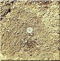
Rivet Felixstowe 153 Langer Road
Rivet, Felixstowe, 153 Langer Road (A154 South) pavement adjacent to Indo European Foods Factory Entrance.
Image: © Cud05 Taken: 11 Feb 2016
0.16 miles
7
Car Park and new buildings
The new development will surround the Martello Tower.
Image: © Adrian S Pye Taken: 17 Sep 2014
0.18 miles
8
Railway towards Port of Felixstowe
Image: © JThomas Taken: 13 May 2023
0.19 miles
9
ROC bunker and Martello Tower
Image: © Robert Eva Taken: 27 Apr 2017
0.19 miles
10
Martello Tower P
Used by the National Coastwatch Institution to maintain a visual watch along the coastline. See also Image
Image: © Bob Jones Taken: 26 Sep 2008
0.20 miles
  • ...