
IMAGES TAKEN NEAR TO
Schneider Close, FELIXSTOWE, IP11 3SS
Introduction
This page details the photographs taken nearby to Schneider Close, IP11 3SS by members of the Geograph project.
The Geograph project started in 2005 with the aim of publishing, organising and preserving representative images for every square kilometre of Great Britain, Ireland and the Isle of Man.

There are currently over 7.5m images from over14,400 individuals and you can help contribute to the project by visiting https://www.geograph.org.uk
Image Map
Images are licensed for reuse under creativecommons.org/licenses/by-sa/2.0
Notes
- Clicking on the map will re-center to the selected point.
- The higher the marker number, the further away the image location is from the centre of the postcode.
Image Listing (14 Images Found)
Images are licensed for reuse under creativecommons.org/licenses/by-sa/2.0
Image
Details
Distance
1
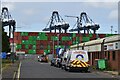
Container storage, Port of Felixstowe
Viewed looking west along Carr Road.
Image: © Simon Mortimer
Taken: 27 Aug 2021
0.10 miles
2
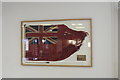
Ensign flown by M V Nordic Ferry while on duty at the Falklands
Unfortunately the glass which protects the "Red Duster" is not non-reflective and is housed in a well-lit environment.
Image: © Adrian S Pye
Taken: 10 Jan 2020
0.12 miles
3
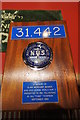
31,442. memorial to the merchant seamen who died in WW2
Housed in The Seafarers' Centre on the Port of Felixstowe
Image: © Adrian S Pye
Taken: 10 Jan 2020
0.12 miles
4
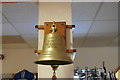
Memorial to The European Gateway
Located in The Seafarers' Centre on the Port of Felixstowe it is in remembrance of the MS European Gateway, a roll-on roll-off (RORO) car and passenger ferry, which collided with MV Speedlink Vanguard and consequently capsized on a sandbank outside the harbour on 19th December 1982. Six people were killed in the capsizing.
She was subsequently refloated and repaired and served the Greek Islands as Penelope, until 2013 when she was scrapped at the Port of Piraeus.
Image: © Adrian S Pye
Taken: 10 Jan 2020
0.12 miles
5
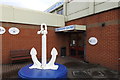
Anchor outside the Seafarers' Centre in Dock Road
Image: © Adrian S Pye
Taken: 10 Jan 2020
0.12 miles
7
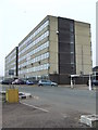
Trelawny House
Office block call Trelawny House at Felixstowe Docks, Suffolk.
Image: © Keith Evans
Taken: 19 Mar 2010
0.18 miles
8

Customs House, Felixstowe
Road access to the Customs House is by Viewpoint Road, from where this photo was taken.
Image: © Bob Jones
Taken: 26 Sep 2008
0.18 miles
10
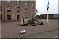
Felixstowe Old Docks memorial display
"Sections of stone from the original dock basin constructed by Col. Tomline in 1886 which formed the foundation of the Port of Felixstowe as it is today."
George (Colonel) Tomline https://en.wikipedia.org/wiki/George_Tomline_(politician)
Image: © Adrian S Pye
Taken: 10 Jan 2020
0.20 miles