
IMAGES TAKEN NEAR TO
Carr Road, FELIXSTOWE, IP11 2TS
Introduction
This page details the photographs taken nearby to Carr Road, IP11 2TS by members of the Geograph project.
The Geograph project started in 2005 with the aim of publishing, organising and preserving representative images for every square kilometre of Great Britain, Ireland and the Isle of Man.

There are currently over 7.5m images from over14,400 individuals and you can help contribute to the project by visiting https://www.geograph.org.uk
Image Map
Images are licensed for reuse under creativecommons.org/licenses/by-sa/2.0
Notes
- Clicking on the map will re-center to the selected point.
- The higher the marker number, the further away the image location is from the centre of the postcode.
Image Listing (49 Images Found)
Images are licensed for reuse under creativecommons.org/licenses/by-sa/2.0
Image
Details
Distance
1
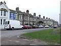
Terrace houses
Terrace houses along Manor Terrace Felixstowe Suffolk.
Image: © Keith Evans
Taken: 4 Jan 2008
0.11 miles
3
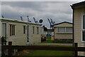
Caravan park and cranes, Manor Terrace, Felixstowe
Image: © Christopher Hilton
Taken: 14 Jul 2021
0.13 miles
4
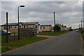
Manor Terrace, Felixstowe
On the extreme left, a stink-pipe allows the escape of gas from a sewer below.
Image: © Christopher Hilton
Taken: 14 Jul 2021
0.17 miles
6
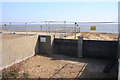
Manor Wall dam boards
The wooden dam boards are removable, to allow vehicular access to the beach; they form part of the flood defences at South Felixstowe.
Image: © Bob Jones
Taken: 26 Sep 2008
0.18 miles
7
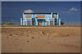
Boarded-up public house
This former pub is on the promenade at South Felixstowe. Despite its proximity to a caravan park, it has closed down.
Image: © Bob Jones
Taken: 26 Sep 2008
0.18 miles
8
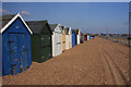
Beach huts at South Felixstowe
The shingle on the promenade is not supposed to be there; it has been thrown up during high water storms. New flood defences should prevent that happening in the foreseeable future. According to one of the beach hut owners, water has been known to be a metre high along this section of the promenade, causing the huts to float and incur substantial damage.
Image: © Bob Jones
Taken: 26 Sep 2008
0.18 miles
9
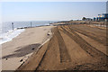
Replenished beach at South Felixstowe
This area of beach, between new groynes 13 and 14, has been replenished with thousands of tonnes of sand and shingle, which has been profiled by bulldozers to enhance flood protection measures.
Image: © Bob Jones
Taken: 26 Sep 2008
0.19 miles
10

Customs House, Felixstowe
Road access to the Customs House is by Viewpoint Road, from where this photo was taken.
Image: © Bob Jones
Taken: 26 Sep 2008
0.19 miles