IMAGES TAKEN NEAR TO
Grange Road, FELIXSTOWE, IP11 2QD
Introduction
This page details the photographs taken nearby to Grange Road, IP11 2QD by members of the Geograph project.
The Geograph project started in 2005 with the aim of publishing, organising and preserving representative images for every square kilometre of Great Britain, Ireland and the Isle of Man.

There are currently over 7.5m images from over14,400 individuals and you can help contribute to the project by visiting https://www.geograph.org.uk
Image Map
Images are licensed for reuse under creativecommons.org/licenses/by-sa/2.0
Notes
- Clicking on the map will re-center to the selected point.
- The higher the marker number, the further away the image location is from the centre of the postcode.
Image Listing (14 Images Found)
Images are licensed for reuse under creativecommons.org/licenses/by-sa/2.0
Image
Details
Distance
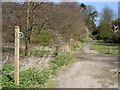
2
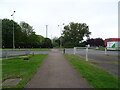
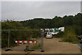
Peewit Hill
Woodland Path near the dock entrance.
Image: © Tim Marchant
Taken: 8 Jul 2009
0.08 miles
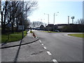
4
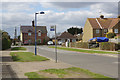
Coronation Drive, Felixstowe
This is the western end of Coronation Drive, showing the junction with Grange Road. The bus stop, marked 'Felixstowe Coronation Drive Philip Avenue' is served by routes 75 and X7 which do a circular trip round the Grange Farm area between journeys from and to Ipswich.
Image: © Stephen McKay
Taken: 26 Mar 2018
0.16 miles
5

Felixstowe-Lidl Superstore
Off Walton Avenue.
Image: © Ian Rob
Taken: 16 May 2022
0.17 miles
6
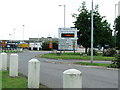
Dock Gate One
One of the dock gates at the port of Felixstowe Suffolk info sign telling you to use dock gate two as one is closed today also see http://www.geograph.org.uk/photo/469316
Image: © Keith Evans
Taken: 17 Jun 2007
0.17 miles
7
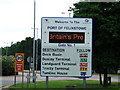
Dock Gate Info Sign
Dock gate one info sign port of Felixstowe Suffolk see other photo http://www.geograph.org.uk/photo/469310
Image: © Keith Evans
Taken: 17 Jun 2007
0.17 miles
9
Vacant site off Walton Avenue, Felixstowe
The map suggests that this was formerly the site of a motel, but is now simply an area used for parking (whether with official sanction or not is unclear).
Image: © Christopher Hilton
Taken: 26 Sep 2021
0.18 miles